We are in the process of migrating all NASA Earth science data sites into Earthdata from now until end of 2026. Not all NASA Earth science data and resources will appear here until then. Thank you for your patience as we make this transition.
Read about the Web Unification Project
Terra Resources
Documents
| Name Sort descending | Description | File Type | Date Published | |
|---|---|---|---|---|
| Development of GHRSST L2Pcore for MODIS (PDF) | Development of GHRSST L2Pcore for MODIS | PDF (1.19 mb) | March 31, 2006 | |
| Development of GHRSST L2Pcore for MODIS (PPT) | Development of GHRSST L2Pcore for MODIS | PPT (1.36 mb) | Nov. 16, 2005 | |
| Discover and Access NASA's Near Real-Time Global Flood Products | This presentation provides an introduction to NASA's near real-time global flood products available through NASA's Land, Atmosphere Near real-time Capability for Earth observation. Information about how to discover, access, and use these NRT products is also provided. | PDF (16.77 mb) | Sept. 17, 2025 | |
| Global Processing of MODIS for Operational SST, Ocean Color, and GHRSST (PDF) | Global Processing of MODIS for Operational SST, Ocean Color, and GHRSST | PDF (1.01 mb) | May 30, 2007 | |
| Global Processing of MODIS for Operational SST, Ocean Color, and GHRSST (PPT) | Global Processing of MODIS for Operational SST, Ocean Color, and GHRSST | PPT (2.73 mb) | Dec. 1, 2005 |
SHOWING 5 OF 60
Terra Learning Resources

This training will cover how soil moisture is modeled within LIS in to improve drought monitoring.
Training
May 17-31, 2023

The eBird tool leverages NASA's remote sensing data to monitor bird populations and habitats and aid in conservation efforts.
Data in Action
May 8, 2023

Join us April 26 at 2 p.m., EDT [UTC -4], to learn about NASA's LAADS DAAC data migration to the cloud and what this means for data users regarding schedule and data access. A live demo of Amazon Simple Storage Service (S3) direct access in the cloud will be provided.
Webinar
April 9, 2023

The virtual Terra, Aqua, Aura Drifting Orbits Workshop takes place Nov 1-2, 2022, from 10 a.m. to 6 p.m., EDT [UTC -4], each day. The workshop is free and registration is open to the public.
Webinar
Oct. 25, 2022

MISR's aerosol amount, particle type, aerosol plume height, and associated wind vector data were contributed to CalFiDE's dataset.
Data in Action
Sept. 30, 2022

This ARSET training focuses on developments and updates in flood monitoring tools and flood modeling techniques.
Training
Sept. 14-21, 2022

This ARSET training outlines the basics of ecosystem services and natural capital accounting.
Training
Aug. 23-30, 2022

This ARSET training provides hands-on exercises to measure urban heat islands and construct heat vulnerability indices.
Training
Aug. 2-11, 2022
SHOWING 8 OF 231
Terra News
View All News
Filters

The Global Land Ice Measurements from Space (GLIMS) Glacier Database provides timely data on more than 200,000 glaciers around the world.
Feature Article
April 8, 2025
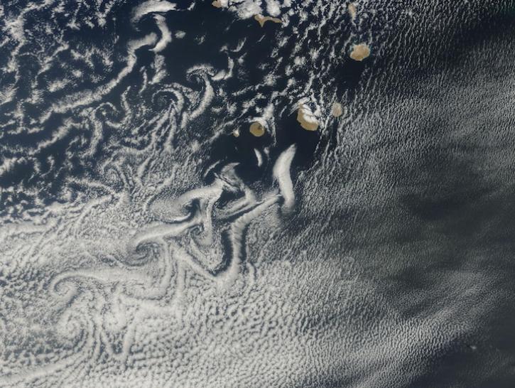
Image captured on Mar 12, 2025, by the MODIS instrument aboard the Terra platform.
Worldview Image of the Week
March 13, 2025

Users of NASA’s Fire Information for Resource Management System (FIRMS) can now differentiate between fires caused by burning vegetation and fires from natural heat sources or industrial heat sources.
Blog
March 7, 2025

A summary of datasets, products, and resources released by NASA’s Distributed Active Archive Centers (DAACs) in February 2025.
News
March 6, 2025
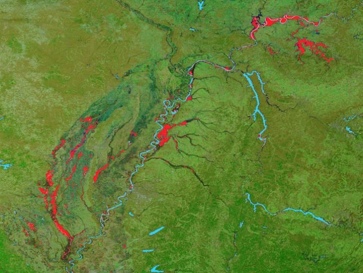
Image captured on February 25, 2025, by the MODIS instrument aboard the Terra platform.
Worldview Image of the Week
Feb. 27, 2025
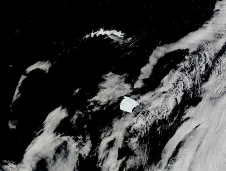
Image captured on Jan 14, 2025, by the MODIS instrument aboard the Terra platform.
Worldview Image of the Week
Jan. 30, 2025

The final processing of Advanced Spaceborne Thermal Emission and Reflection Radiometer (ASTER) data will make its archive more accessible to users.
Feature Article
Jan. 21, 2025

The Help Hub hosted by NASA's Ocean Biology Distributed Active Archive Center (OB.DAAC) has been updated with new learning resources for processing ocean color satellite data, working with Plankton, Aerosol, Cloud, ocean Ecosystem (PACE) data, and more.
News
Jan. 15, 2025
SHOWING 8 OF 448
Frequently Asked Questions
Earthdata Forum
Our online forum provides a space for users to browse thousands of FAQs about research needs, data, and data applications. You can also submit new questions for our experts to answer.
Submit Questions to Earthdata Forumand View Expert Responses