We are in the process of migrating all NASA Earth science data sites into Earthdata from now until end of 2026. Not all NASA Earth science data and resources will appear here until then. Thank you for your patience as we make this transition.
Read about the Web Unification Project
ISS Resources
ISS Learning Resources

This ARSET training introduces how NASA earth observations can contribute to a greater understanding of energy management applications.
Training
June 1-22, 2021

Read highlights of three publications that detail how NASA Earth observation data informs forest structure mapping, disease vector tracking, and mineral identification.
Data in Action
April 26, 2021
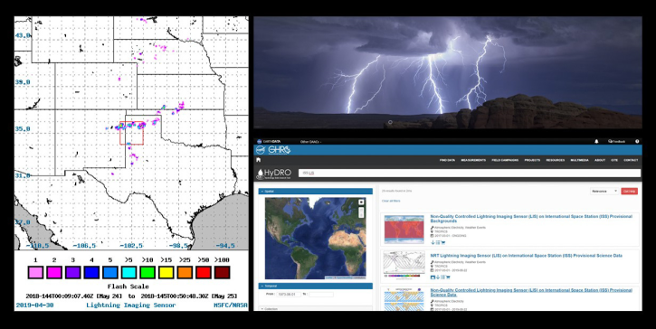
Join us to learn about the importance of lightning observations- for seasonal and long-term trends in lightning activity. We will focus on data and applications from the International Space Station's (ISS) Lightning Imaging Sensor (LIS) instrument.
Webinar
April 20, 2021
Esta capacitación de ARSET cubre los fundamentos de SIF y lidar, sus aplicaciones y una descripción general de las diferentes fuentes de datos.
Training
March 16-25, 2021
This ARSET training covers the fundamentals of solar induced fluorescence and lidar, their applications, and an overview of different data sources.
Training
March 16-25, 2021

Discover how a NASA DEVELOP team used NASA Earth science remote sensing data to observe the impacts urban growth has had on the city of Huntsville, Alabama.
Data in Action
Nov. 17, 2020

This ARSET training covers the use of remote sensing in determining and explaining urban heat islands, and ways to mitigate the effects.
Training
Nov. 10-24, 2020

See how the Tennessee Valley Energy DEVELOP team used Earth observations to predict river water temperatures for managing and protecting aquatic ecosystems.
Data in Action
July 1, 2020
SHOWING 8 OF 75
ISS News
View All News
Filters

The ability for Synthetic Aperture Radar (SAR) to create high-resolution imagery regardless of atmospheric conditions makes it a key technology for studies of change over time. Dr. Paul Siqueira’s work improves these sensors and the Earth observing data they collect.
Data User Story
April 22, 2021
Data from NASA’s Global Ecosystem Dynamics Investigation (GEDI) mission are adding to our understanding of carbon cycling and the structure and development of global biomes.
Feature Article
April 21, 2021
ORNL DAAC has released a new Level 3 data product from the Global Ecosystem Dynamics Investigation (GEDI) mission offering gridded estimates of canopy height and ground elevation.
News
April 20, 2021
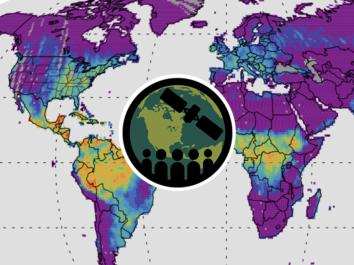
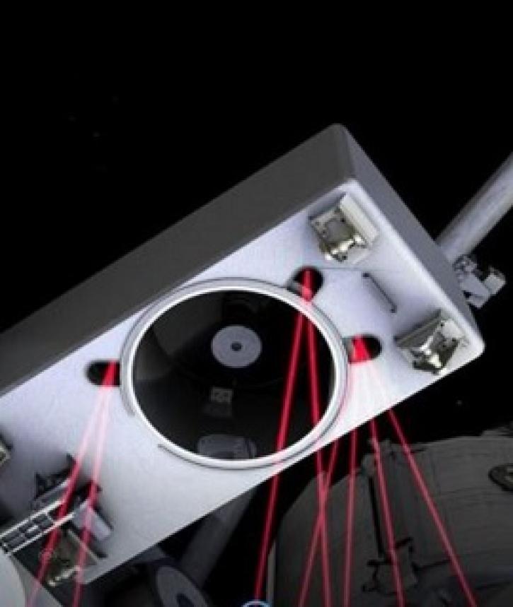
The installation of a Lightning Imaging Sensor (LIS) on the International Space Station (ISS) will enable detection of 98% of Earth's lightning on an annual basis.
News
April 20, 2021
Provisional data from the Lightning Imaging Sensor aboard the International Space Station - LIS (ISS) are now available through NASA's GHRC DAAC and LANCE.
News
April 20, 2021
Researchers stalk seasonal lightning in the most struck place on Earth.
Feature Article
April 19, 2021

Lightning is much more complex—and extreme—than you think.
Feature Article
April 19, 2021

ALTUS Cumulus Electrification Study (ACES) help validate LIS data to examine thunderstorms.
Feature Article
April 19, 2021
SHOWING 8 OF 80
Frequently Asked Questions
Earthdata Forum
Our online forum provides a space for users to browse thousands of FAQs about research needs, data, and data applications. You can also submit new questions for our experts to answer.
Submit Questions to Earthdata Forumand View Expert Responses