We are in the process of migrating all NASA Earth science data sites into Earthdata from now until end of 2026. Not all NASA Earth science data and resources will appear here until then. Thank you for your patience as we make this transition.
Read about the Web Unification Project
Aqua Resources
Earthdata resources for users working with NASA’s Aqua data include tutorials and other learning resources, news announcements such as instrument updates and data releases, user guides and related documents, and frequently asked questions.
Documents
| Name Sort descending | Description | File Type | Date Published | |
|---|---|---|---|---|
| High Resolution MODIS Ocean Color | High Resolution MODIS Ocean Color | PPT (1.63 mb) | April 5, 2006 | |
| MODIS and Ocean Color Discipline Processing (PDF) | MODIS and Ocean Color Discipline Processing | PDF (4.55 mb) | Aug. 16, 2005 | |
| MODIS and Ocean Color Discipline Processing (PPT) | MODIS and Ocean Color Discipline Processing | PPT (1.84 mb) | Dec. 21, 2000 | |
| MODIS Land Bands for Ocean Remote Sensing: Application to Chesapeake Bay | MODIS Land Bands for Ocean Remote Sensing: Application to Chesapeake Bay | PPT (3.47 mb) | Dec. 1, 2005 | |
| MODIS Land Bands for Ocean Remote Sensing: Application to Chesapeake Bay (PDF) | MODIS Land Bands for Ocean Remote Sensing: Application to Chesapeake Bay | PDF (2.73 mb) | Nov. 2, 2006 |
SHOWING 5 OF 20
Aqua Learning Resources

The eBird project uses NASA data and observations from amateur birdwatchers to provide insights into the decline in avian populations throughout North America.
Data in Action
June 17, 2025

Agricultural burning in Kansas produces smoky skies and healthy crops.
Data in Action
June 6, 2025

Artificial intelligence methods can be powerful tools to study our oceans.
Data in Action
Dec. 12, 2024

Sentinel-6 and Multi-Scale Ultra-High Resolution data reveal how Hurricane Helene rapidly intensified in the warm Gulf waters.
Data in Action
Oct. 3, 2024

Join us to learn more about datasets and tools that enable the harmonization of remote sensing and in situ ecological data products for site-based research.
Webinar
Aug. 22, 2024

Due to unforeseen circumstances, this webinar is postponed and will be rescheduled soon. We apologize for the short notice and appreciate your continued interest and support. We look forward to your attendance at our rescheduled webinar, to be announced.
Webinar
June 26, 2024

This ARSET training focuses on flood risk, heat stress, and drought effects on agricultural landscapes in refugee settings.
Training
June 6-20, 2024

This webinar introduces the Geostationary Earth Orbit (GEO)-Low-Earth Orbit (LEO) Dark Target Aerosol data product suite and shows how to find, access, and download the data.
Webinar
May 16, 2024
SHOWING 8 OF 184
Aqua News
View All News
Filters
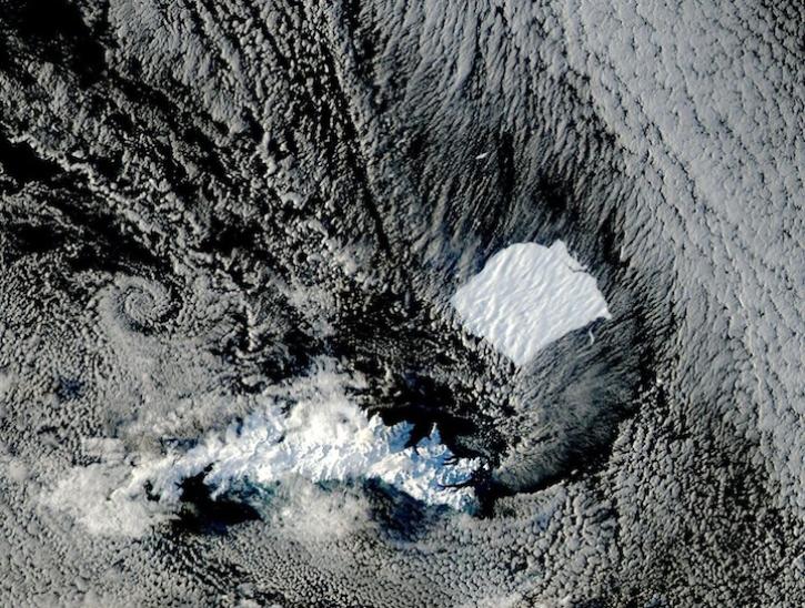
Image captured on August 17 and 19, 2025, by the MODIS instrument aboard the Aqua platform.
Worldview Image of the Week
Aug. 21, 2025

A summary of datasets, products, and resources released by NASA’s Distributed Active Archive Centers (DAACs) in July 2025.
News
Aug. 13, 2025
A summary of datasets, products, and resources released by NASA’s Distributed Active Archive Centers (DAACs) in June 2025.
News
July 18, 2025

Join NASA’s LAADS DAAC to learn how new tools available through Harmony services help users work with Level-1 and atmospheric datasets more efficiently.
Webinar
July 16, 2025
Researchers from Cornell's eBird project used observations from amateur birdwatchers and NASA data to better understand the decline in avian populations throughout North America.
News
June 17, 2025
FIRMS was used to track the spread of smoke plumes during the Canadian wildland fires in June 2025.
Blog
June 17, 2025
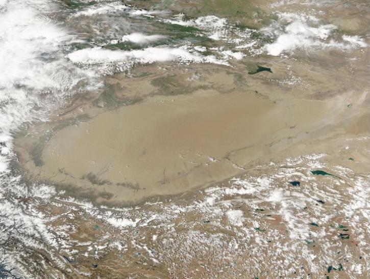
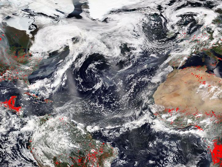
Image captured June 10, 2025, by the MODIS and AIRS instruments aboard the Aqua platform.
Worldview Image of the Week
June 13, 2025
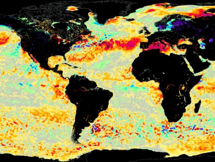
Image for June 8, 2025, from the GHRSST sea surface temperature analysis.
Worldview Image of the Week
June 9, 2025
SHOWING 8 OF 356
Frequently Asked Questions
Earthdata Forum
Our online forum provides a space for users to browse thousands of FAQs about research needs, data, and data applications. You can also submit new questions for our experts to answer.
Submit Questions to Earthdata Forumand View Expert Responses