We are in the process of migrating all NASA Earth science data sites into Earthdata from now until end of 2026. Not all NASA Earth science data and resources will appear here until then. Thank you for your patience as we make this transition.
Read about the Web Unification Project
Aqua Resources
Earthdata resources for users working with NASA’s Aqua data include tutorials and other learning resources, news announcements such as instrument updates and data releases, user guides and related documents, and frequently asked questions.
Documents
| Name Sort descending | Description | File Type | Date Published | |
|---|---|---|---|---|
| MODIS Ocean Data Processing (PDF) | MODIS Ocean Data Processing | PDF (4.38 mb) | May 30, 2007 | |
| MODIS Ocean Data Processing (PPT) | MODIS Ocean Data Processing | PPT (15.82 mb) | Dec. 1, 2005 | |
| MODIS SST Processing and Support for GHRSST at OBPG | MODIS SST Processing and Support for GHRSST at OBPG | PDF (1.23 mb) | Nov. 28, 2005 | |
| MODIS SST Processing and Support for GHRSST at OBPG (PPT) | MODIS SST Processing and Support for GHRSST at OBPG (PPT) | PPT (1.4 mb) | Nov. 16, 2005 | |
| MODIS Terra/Aqua | MODIS Terra/Aqua | PDF (155.7 kb) | April 19, 2004 |
SHOWING 5 OF 20
Aqua Learning Resources

Learn more about NASA's Application for Extracting and Exploring Analysis Ready Samples (AppEEARS). This webinar showcases the system's capabilities and highlights learning resources to help simplify data access workflows using AppEEARS.
Webinar
April 9, 2024

This training provides an overview of spectral indices for land and aquatic applications.
Training
Oct. 26 - Nov. 9, 2023

This ARSET training covers the basics of natural hazard risk modeling and exposure development.
Training
Oct. 3-10, 2023
Esta capacitación de ARSET cubre los fundamentos de la modelación de riesgo de amenazas naturales y desarrollo de exposición.
Training
Oct. 3-10, 2023

Learn how to use NASA's Fire Information for Resource Management System (FIRMS) and its enhanced User Interface that provides additional services and analysis capabilities for wildfire management.
Webinar
Sept. 29, 2023

This advanced-level training focuses on using remote sensing observations for monitoring post-fire impacts on watershed health.
Training
July 6-13, 2023

Satellite data provides indicators of El Niño events.
Data in Action
June 15, 2023

This training will cover how soil moisture is modeled within LIS in to improve drought monitoring.
Training
May 17-31, 2023
SHOWING 8 OF 184
Aqua News
View All News
Filters

Annual prescribed burns are crucial for improving and maintaining pasture and crop land health, and remote sensing data provides near real-time information on location and air quality.
News
June 6, 2025
The new VIIRS near real-time product is already in use, and users are encouraged to explore this replacement option for MODIS-based flood products.
Blog
June 2, 2025
A summary of datasets, products, and resources released by NASA’s Distributed Active Archive Centers (DAACs) in April 2025.
News
May 13, 2025

Image captured on Apr 10, 2025, by the MODIS instrument aboard the Terra platform.
Worldview Image of the Week
April 11, 2025

Users of NASA’s Fire Information for Resource Management System (FIRMS) can now differentiate between fires caused by burning vegetation and fires from natural heat sources or industrial heat sources.
Blog
March 7, 2025
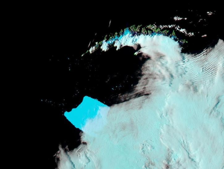
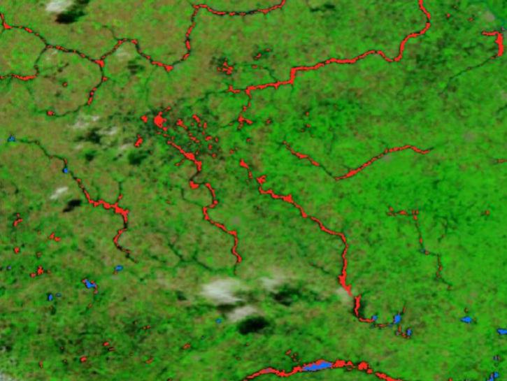
Image captured on Mar 4, 2025, by the MODIS instrument aboard the Aqua platform.
Worldview Image of the Week
March 6, 2025

A summary of datasets, products, and resources released by NASA’s Distributed Active Archive Centers (DAACs) in February 2025.
News
March 6, 2025

The Help Hub hosted by NASA's Ocean Biology Distributed Active Archive Center (OB.DAAC) has been updated with new learning resources for processing ocean color satellite data, working with Plankton, Aerosol, Cloud, ocean Ecosystem (PACE) data, and more.
News
Jan. 15, 2025
SHOWING 8 OF 356
Frequently Asked Questions
Earthdata Forum
Our online forum provides a space for users to browse thousands of FAQs about research needs, data, and data applications. You can also submit new questions for our experts to answer.
Submit Questions to Earthdata Forumand View Expert Responses