We are in the process of migrating all NASA Earth science data sites into Earthdata from now until end of 2026. Not all NASA Earth science data and resources will appear here until then. Thank you for your patience as we make this transition.
Read about the Web Unification Project
Floods News
Articles, resources, and announcements from Floods.

Image captured on 7 March 2020, by the MODIS instrument, aboard the Terra satellite.
Worldview Image of the Week
Nov. 3, 2020

Image captured on 13 October 2019, by the MODIS instrument, aboard the Aqua satellite.
Worldview Image of the Week
Nov. 3, 2020

Read the latest papers focused on applications of socioeconomic data.
News
Sept. 19, 2020
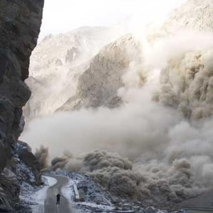
Scientists and satellites hold vigil on a newborn lake in Pakistan.
Feature Article
July 28, 2020

A new long-term archive of satellite data will help hydrologists monitor floods, allow aid agencies to pinpoint flood-prone regions, and provide information for modeling Earth's complex hydrologic cycles.
Feature Article
July 28, 2020

As wildlands shrink, scientists study the ecologies that people have tamed.
Feature Article
July 28, 2020
Synthetic Aperture Radar aboard the JERS-1 satellite collects data from the world's tropical forests.
Feature Article
July 22, 2020

Finding a model that doesn't require recalibration from watershed to watershed.
Feature Article
July 21, 2020
SHOWING 8 OF 48