We are in the process of migrating all NASA Earth science data sites into Earthdata from now until end of 2026. Not all NASA Earth science data and resources will appear here until then. Thank you for your patience as we make this transition.
Read about the Web Unification Project
Filters

Submit your abstract for a workshop hosted by NASA and ESA (European Space Agency) focused on the opportunities and challenges of integrating foundation models into the Earth observation (EO) and Earth science ecosystems. The abstract submission deadline is January 31, 2025.
Event
Jan. 14, 2025

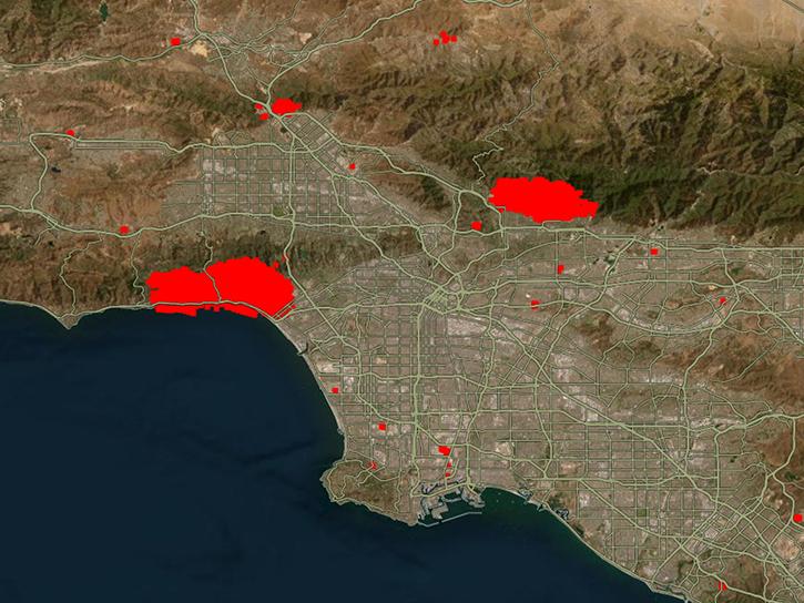
Satellite-based maps offer quick first alerts and approximate locations of potential wildfires that are then precisely tracked and fought by teams on the ground.
Feature Article
Jan. 13, 2025
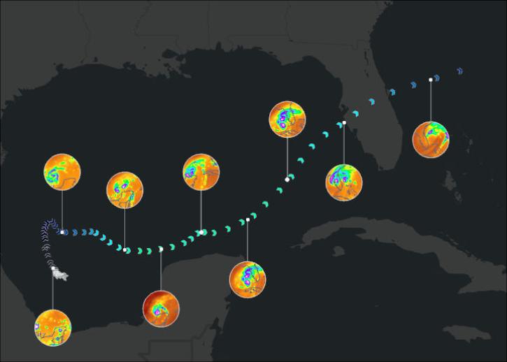
Join us on January 29 at 2PM ET (-05:00 UTC) to learn how to access and use MERRA-2, GPM, TROPICS, and LDAS data provided by NASA's Goddard Earth Sciences Data and Information Services Center (GES DISC) to investigate Hurricane Milton's milestones.
Webinar
Jan. 10, 2025

Image captured on Jan 8, 2025, by the MODIS instrument aboard the Aqua platform.
Worldview Image of the Week
Jan. 9, 2025
NASA's Physical Oceanography Distributed Active Archive Center (PO.DAAC) and Jet Propulsion Laboratory (JPL) are experiencing operational outages that may affect data processing.
News
Jan. 9, 2025

The atlas now features NASA Earth science data formatted specifically for geographic information systems (GIS) users.
Feature Article
Jan. 7, 2025

A summary of datasets, products, and resources released by NASA’s Distributed Active Archive Centers (DAACs) in December 2024.
News
Jan. 6, 2025

Image captured on January 2, 2025, by the VIIRS instrument aboard the NOAA-21 platform.
Worldview Image of the Week
Jan. 3, 2025
SHOWING 8 OF 2379