We are in the process of migrating all NASA Earth science data sites into Earthdata from now until end of 2026. Not all NASA Earth science data and resources will appear here until then. Thank you for your patience as we make this transition.
Read about the Web Unification Project
Filters

For more than 30 years, NASA and its partners have flown satellite altimeter missions providing essential sea level change data to inform coastal communities.
Data in Action
Feb. 5, 2025

The VITALS repository provides Python Jupyter notebook examples to help users work with VSWIR and TIR data from the EMIT and ECOSTRESS missions.
News
Feb. 3, 2025

Learn how to create and unwrap an interferogram with GMT5SAR script in the cloud for Windows in NASA’s Alaska Satellite Facility Distributed Active Archive Center (ASF DAAC) tutorial.
Tutorial
Feb. 3, 2025

Learn to create and unwrap an interferogram with GMT5SAR script in the cloud — OS X in this data recipe from NASA’s Alaska Satellite Facility Distributed Active Archive Center (ASF DAAC).
Data Recipe
Feb. 3, 2025

Learn how to create a deformation map from unwrapped interferograms in this data recipe from NASA’s Alaska Satellite Facility Distributed Active Archive Center (ASF DAAC).
Data Recipe
Feb. 3, 2025

Learn how to transfer files into and out of a Linux EC2 instance from a local computer running Windows by two different methods.
Data Recipe
Feb. 3, 2025
In the second ICESat-2 webinar, learn how to work with land and vegetation height data. A live demonstration will showcase the SlideRule Earth web service which provides on-demand science data processing.
Webinar
Jan. 31, 2025
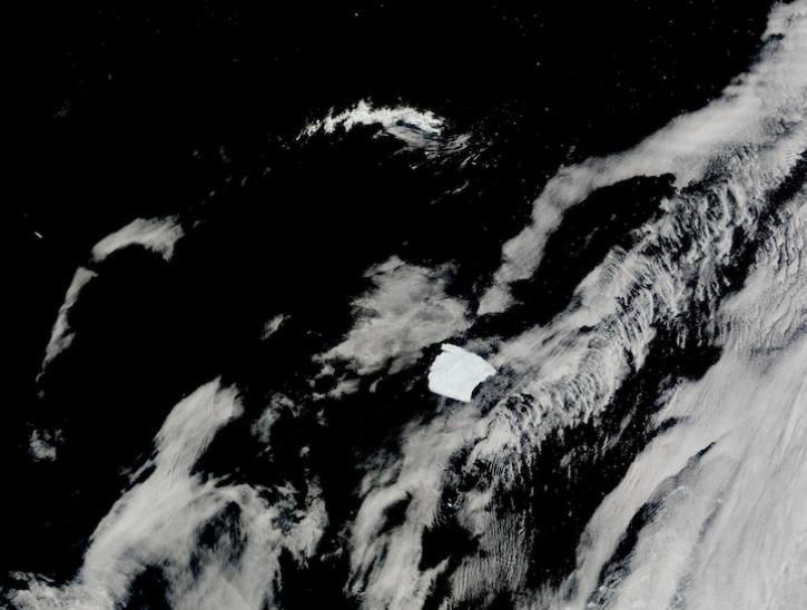
Image captured on Jan 14, 2025, by the MODIS instrument aboard the Terra platform.
Worldview Image of the Week
Jan. 30, 2025
SHOWING 8 OF 2379