We are in the process of migrating all NASA Earth science data sites into Earthdata from now until end of 2026. Not all NASA Earth science data and resources will appear here until then. Thank you for your patience as we make this transition.
Read about the Web Unification Project
Filters

The radiometric terrain corrected synthetic aperture radar data are NASA’s first to meet Committee on Earth Observations Satellites specifications.
News
Dec. 11, 2024
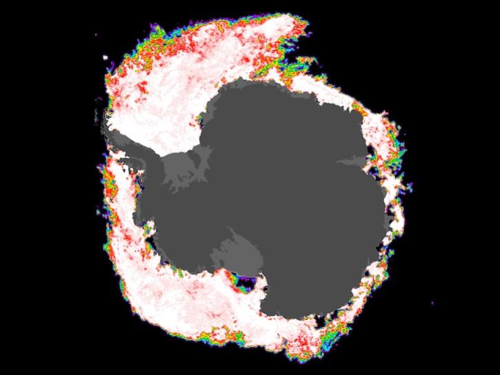
Image composite from Dec 1, 2024, captured by the AMSR2 instrument aboard the GCOM-W1 platform.
Worldview Image of the Week
Dec. 5, 2024

A summary of datasets, products, and resources released by NASA’s Distributed Active Archive Centers (DAACs) in November 2024.
News
Dec. 4, 2024
The second version of the Earth System Data Explorer data visualization tool uses Google Earth Engine and adds new resources for data exploration.
Blog
Dec. 3, 2024
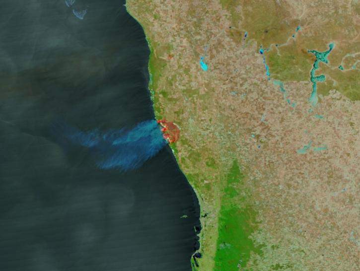
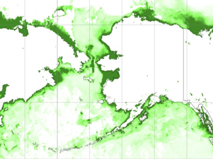
Image captured on Nov 28, 2024, by the VIIRS instrument aboard the NOAA-21 platform.
Worldview Image of the Week
Nov. 29, 2024

Image captured on Nov 19, 2024, at 3:20 p.m., EDT [20:20 UTC], by the Advanced Baseline Imager (ABI) instrument aboard the GOES-West platform.
Worldview Image of the Week
Nov. 21, 2024

The ACTIVATE team hosted its final science team meeting on November 20, 2024.
Event
Nov. 20, 2024

To celebrate GIS Day, take a peek at these illuminating examples of NASA Earth Science leveraging Geographic Information Systems (GIS) to understand our home planet.
News
Nov. 20, 2024
SHOWING 8 OF 2379