We are in the process of migrating all NASA Earth science data sites into Earthdata from now until end of 2026. Not all NASA Earth science data and resources will appear here until then. Thank you for your patience as we make this transition.
Read about the Web Unification Project
Filters
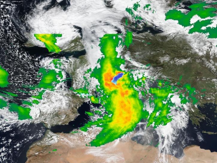
Image captured on Apr 16, 2025, by the VIIRS instrument aboard the Suomi NPP platform, with IMERG Precipitation Rate.
Worldview Image of the Week
April 17, 2025
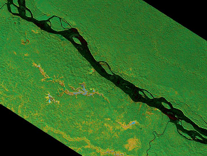
The SAR Handbook was created in 2019 as a guide for forest monitoring and biomass estimation with synthetic aperture radar (SAR).
Data Basics
April 16, 2025

Learn more about the NASA Commercial Satellite Data Acquisition (CSDA) program vendor ICEYE US and how to discover, access, and work with ICEYE's high-resolution SAR products.
Webinar
April 15, 2025

Image captured on Apr 10, 2025, by the MODIS instrument aboard the Terra platform.
Worldview Image of the Week
April 11, 2025
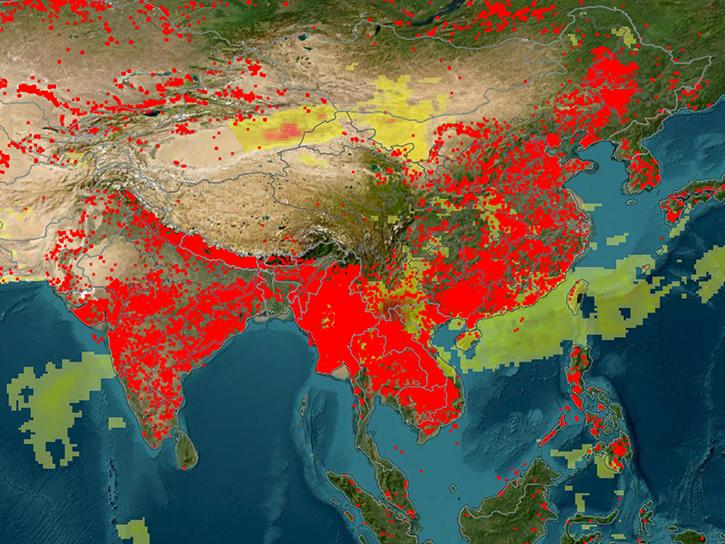
An upcoming training offered by NASA's ARSET program explores how to use FIRMS to track wildland fire activity and its effects.
News
April 9, 2025
Learn how to use the Open-source Project for a Network Data Access Protocol (OPeNDAP) to access NASA’s Earth science datasets—specifically those in HDF5, HDF4, and HDF4-EOS2 formats.
Webinar
April 8, 2025

The Global Land Ice Measurements from Space (GLIMS) Glacier Database provides timely data on more than 200,000 glaciers around the world.
Feature Article
April 8, 2025
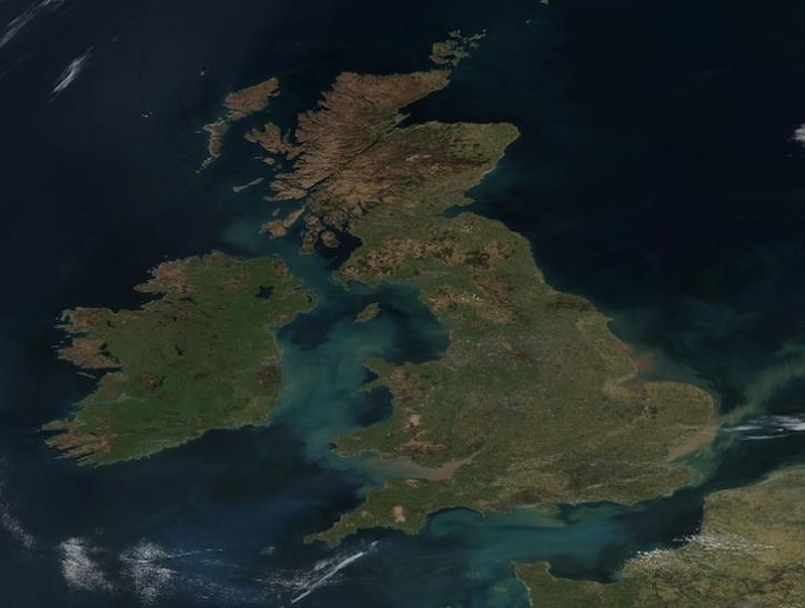
Image captured on Apr 2, 2025, by the VIIRS instrument aboard the joint NASA/NOAA Suomi NPP platform.
Worldview Image of the Week
April 4, 2025
SHOWING 8 OF 2379