We are in the process of migrating all NASA Earth science data sites into Earthdata from now until end of 2026. Not all NASA Earth science data and resources will appear here until then. Thank you for your patience as we make this transition.
Read about the Web Unification Project
Filters
With its high-resolution HawkEye instrument, SeaHawk has shown CubeSats are an inexpensive and timely way to obtain high-quality ocean color data.
Feature Article
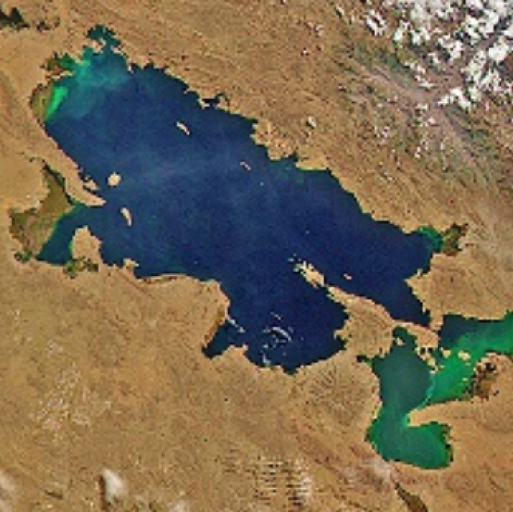
Oct. 20, 2021

Image captured on Sep 12, 2021, by the MODIS instrument aboard the Aqua satellite.
Worldview Image of the Week
Oct. 20, 2021

Data available from NASA’s LP DAAC helps scientists like Dr. Robert Wright develop systems for autonomously detecting volcanic eruptions from space.
Data User Story
Oct. 20, 2021
Synthetic aperture radar (SAR) data is essential to projects that monitor the ice sheets of Greenland and Antarctica.
Data User Story
Oct. 10, 2021

Researchers used satellite and saildrone data to measure sea surface salinity in coastal waters freshened by river runoff in the Yukon Delta.
Data in Action
Oct. 5, 2021

A research team using NASA data is the first to combine temperature, relative humidity, and population data in their study of extreme heat exposure.
News
Oct. 4, 2021

This demonstrates how to ingest FIRMS fire data provided as Web Feature Services (WFS) into ArcGIS Desktop v10.7.1 and custom modify symbols, colors and size.
Tutorial
Sept. 28, 2021

This demonstrates how to ingest FIRMS fire data provided as Web Feature Services (WFS) into ArcGIS Pro and custom modify symbols, colors and size.
Tutorial
Sept. 28, 2021
SHOWING 8 OF 2379