We are in the process of migrating all NASA Earth science data sites into Earthdata from now until end of 2026. Not all NASA Earth science data and resources will appear here until then. Thank you for your patience as we make this transition.
Read about the Web Unification Project
Filters

Explore how scientists use NASA Earth observation data to monitor Arctic lake temperatures, map urban heat variations, and track endangered Shoebill movements across three diverse ecosystems.
Data in Action
Nov. 8, 2021

Registration is now open for this year’s virtual hackathon, which will take place October 2-3
Feature Article
Nov. 4, 2021

Image captured on 29 August 2021, by the VIIRS instrument, aboard the joint NASA/NOAA NOAA-20 satellite.
Worldview Image of the Week
Nov. 1, 2021
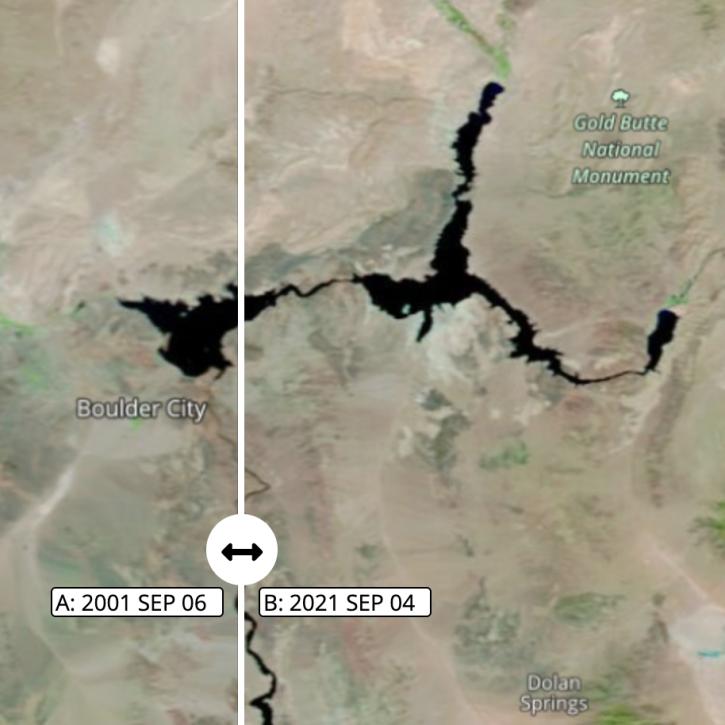
Images captured on Sep 6 and Sep 4, 2021, by the MODIS instrument aboard the Terra satellite.
Worldview Image of the Week
Nov. 1, 2021

Image captured on Aug 16, 2021, by the MODIS instrument aboard NASA's Terra satellite.
Worldview Image of the Week
Nov. 1, 2021
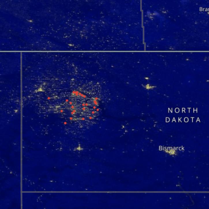
Image captured on Sep 27, 2021, by the VIIRS instrument aboard the joint NASA/NOAA Suomi NPP satellite.
Worldview Image of the Week
Oct. 29, 2021

Image captured on Oct 3, 2021, by the MODIS instrument aboard the Aqua satellite.
Worldview Image of the Week
Oct. 28, 2021

ASDC hosted an open data workshop for researchers to learn about the types of data collected during the NASA DCOTSS airborne field campaign in 2021.
Event
Oct. 28, 2021
SHOWING 8 OF 2379