We are in the process of migrating all NASA Earth science data sites into Earthdata from now until end of 2026. Not all NASA Earth science data and resources will appear here until then. Thank you for your patience as we make this transition.
Read about the Web Unification Project
Filters

NASA’s Terra mission soon will shift to Phase F: decommissioning. Here's what this means for the future of this groundbreaking satellite.
Feature Article
May 3, 2022

The new Sea Level Change Data Pathfinder highlights the different datasets used to piece together the status and drivers of sea level rise.
Feature Article
Feb. 18, 2022

Listing of ESDS program elements AGU sessions, posters, elightning talks and workshops for the Hybrid Fall AGU 2021 Annual Meeting.
Feature Article
Feb. 1, 2022
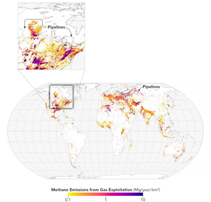
Scientists map 97 million metric tons of methane emissions from the exploitation of oil, natural gas, and coal.
Feature Article
Jan. 31, 2022

Launched September 27, Landsat 9 will provide a high-quality and reliable stream of land imaging data for the next 10-plus years.
Feature Article
Jan. 31, 2022
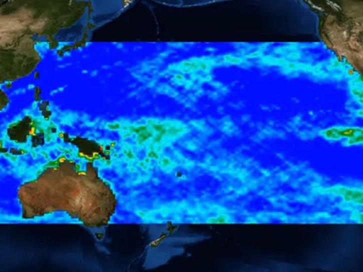
Researchers are using satellite data and machine learning to map microplastic concentrations across the ocean.
Feature Article
Jan. 31, 2022

The contract expansion significantly broadens the availability of Planet imagery distributed by NASA's Commercial SmallSat Data Acquisition (CSDA) program.
Feature Article
Jan. 25, 2022

GeoColor imagery’s quality, frequency, and interpretability will boost the amount of near real-time imagery available in Worldview, making it even more valuable to users.
Feature Article
Jan. 25, 2022
SHOWING 8 OF 534