We are in the process of migrating all NASA Earth science data sites into Earthdata from now until end of 2026. Not all NASA Earth science data and resources will appear here until then. Thank you for your patience as we make this transition.
Read about the Web Unification Project
Filters
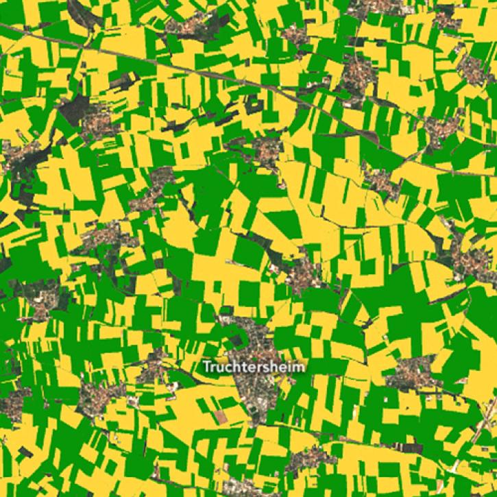
New research uses 3D lidar profiles of Earth's surface to map where corn is being grown.
Feature Article
May 18, 2022
Harmony, NASA’s Earthdata Cloud Services System, allows users to produce analysis-ready data by subsetting, reprojecting, and converting data to a cloud-optimized format.
Feature Article
May 18, 2022

A NASA Airborne and Field Data Working Group workshop gathered valuable feedback to improve the acquisition and use of airborne and field data.
Feature Article
May 18, 2022

Customer satisfaction scores for EOSDIS products and services rose to their highest level, outpacing previous survey benchmarks
Feature Article
May 18, 2022

With the eventual retirement of the Terra and Aqua platforms, the Visible Infrared Imaging Radiometer Suite (VIIRS) instruments will take the lead in daily Earth observations.
Feature Article
May 18, 2022

This Earth Day we invite you to explore global, full-resolution NASA Earth science imagery to see volcanoes erupting, wildfires spreading, tropical cyclones forming, and city lights illuminating. With NASA Worldview, you can also take a snapshot, create an animated GIF, or compare imagery from two dates to view changes over time.
Feature Article
May 17, 2022

Since 2002, NASA’s Aqua satellite has orbited the Earth more than 100,000 times, and produced one of the longest near-continuous records of Earth observation data ever assembled.
Feature Article
May 17, 2022

The data are part of ongoing efforts by NASA’s Commercial SmallSat Data Acquisition (CSDA) Program to add commercial SmallSat data to NASA’s Earth science data collection.
Feature Article
May 17, 2022
SHOWING 8 OF 534