We are in the process of migrating all NASA Earth science data sites into Earthdata from now until end of 2026. Not all NASA Earth science data and resources will appear here until then. Thank you for your patience as we make this transition.
Read about the Web Unification Project
Filters
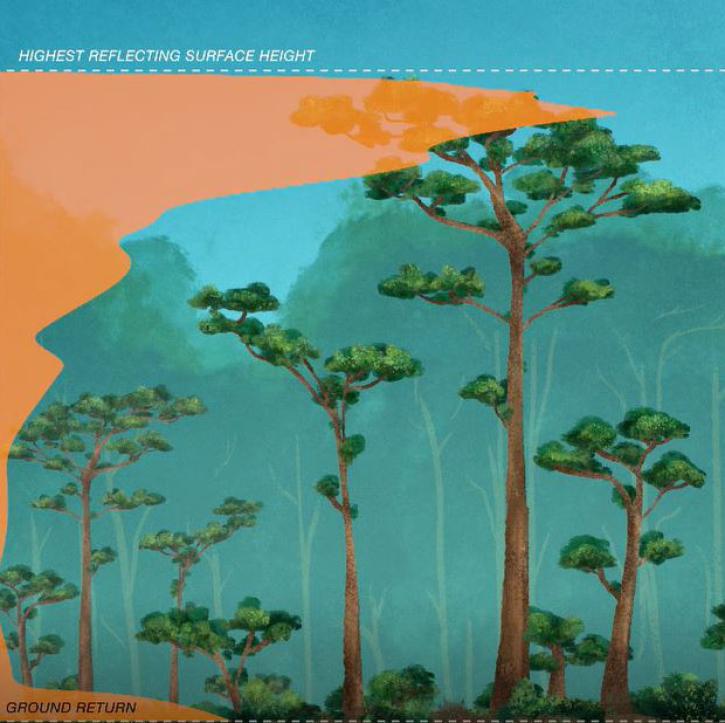
New dataset provides the first high-resolution 3D aboveground biomass density estimates for tropical and temperate forests around the globe.
Feature Article
Jan. 25, 2022
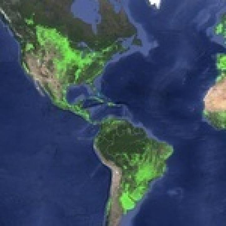
The Global Food Security-support Analysis Data (GFSAD) collection provides detailed maps of agricultural croplands around the world at 30-meter spatial resolution.
Feature Article
Jan. 25, 2022

A new suite of data products from NASA's TROPESS project offers measurements of atmospheric trace gasses.
Feature Article
Jan. 10, 2022
Summer interns supporting NASA’s Interagency Implementation and Advanced Concepts Team (IMPACT) helped advance several IMPACT machine learning initiatives.
Feature Article
Jan. 10, 2022

Over 4,300 people competed in the Earth Observation (EO) Dashboard Hackathon. Find out which eight projects are Global Winners.
Feature Article
Jan. 5, 2022

ESDIS Project, CSDA Program, and EOSDIS DAAC interns advance critical NASA initiatives and gain valuable workplace experience while working remotely.
Feature Article
Jan. 3, 2022
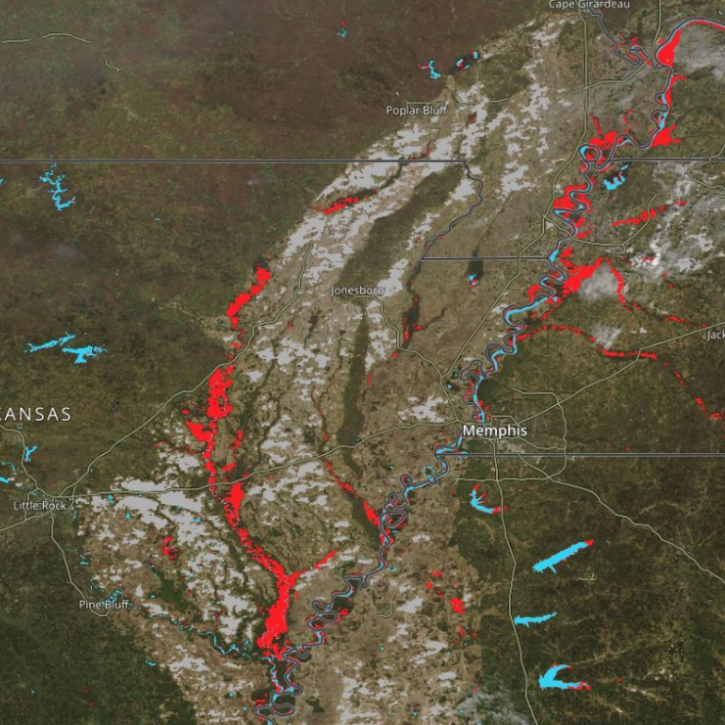
New Near Real-Time (NRT) Global Flood Mapping product from LANCE will continue production of data critical for detecting floods around the globe.
Feature Article
Dec. 27, 2021
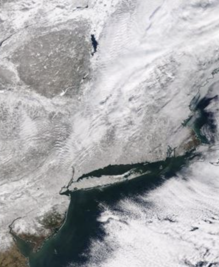
IMPACTS—the first campaign to study intense East Coast snowstorms in the past 30 years—aims to give scientists a better understanding of what drives the processes that generate snowfall in the snowbands of intense storms.
Feature Article
Dec. 27, 2021
SHOWING 8 OF 534