We are in the process of migrating all NASA Earth science data sites into Earthdata from now until end of 2026. Not all NASA Earth science data and resources will appear here until then. Thank you for your patience as we make this transition.
Read about the Web Unification Project
Jason-1 Resources
Jason-1 Learning Resources
This ARSET training focuses on NASA products available to assess sea level change.
Training
June 10-17, 2025

For more than 30 years, NASA and its partners have flown satellite altimeter missions providing essential sea level change data to inform coastal communities.
Data in Action
Feb. 5, 2025

Sentinel-6 and Multi-Scale Ultra-High Resolution data reveal how Hurricane Helene rapidly intensified in the warm Gulf waters.
Data in Action
Oct. 3, 2024
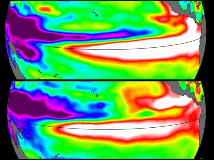
Sea surface height data from the Sentinel-6 Michael Freilich mission reveal complex interactions between the ocean and the atmosphere that affect global weather and climate such as El Niño.
Data in Action
Oct. 31, 2023

SWOT provides high-resolution data to help researchers monitor the vertical transport of heat and carbon within the ocean.
Data in Action
Sept. 15, 2023
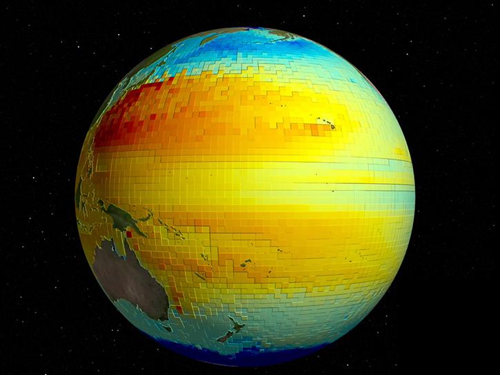
SWOT and ECCO can measure sea surface height at different resolutions for monitoring the ocean's vertical heat, carbon transport, and other processes.
Data in Action
Nov. 2, 2022

Improvements in the new version of this gridded product enhance data collection for the oceanography and climate science communities.
Data in Action
June 15, 2022

This ARSET training introduces how NASA earth observations can contribute to a greater understanding of energy management applications.
Training
June 1-22, 2021
SHOWING 8 OF 12
Jason-1 News
View All News
Filters

Sentinel-6B observations will also inform early warnings and forecasts systems.
News
Dec. 16, 2025

The new Sea Level Change Data Pathfinder highlights the different datasets used to piece together the status and drivers of sea level rise.
Feature Article
Feb. 18, 2022

Knowing exactly where you are isn't good enough for science.
Feature Article
Dec. 28, 2020

Satellite data help sea-going oceanographers pursue an elusive ocean layer.
Feature Article
Dec. 28, 2020


The global average sea level is rising. Dr. Philip Thompson uses NASA Earth science data to explore how—and when—this will affect vulnerable communities.
Data User Story
Dec. 22, 2020

Data from Jason and TOPEX/Poseidon give scientists the first detailed profile of a major tsunami event.
Feature Article
July 22, 2020
SHOWING 8 OF 9
Frequently Asked Questions
Earthdata Forum
Our online forum provides a space for users to browse thousands of FAQs about research needs, data, and data applications. You can also submit new questions for our experts to answer.
Submit Questions to Earthdata Forumand View Expert Responses