We are in the process of migrating all NASA Earth science data sites into Earthdata from now until end of 2026. Not all NASA Earth science data and resources will appear here until then. Thank you for your patience as we make this transition.
Read about the Web Unification Project
AMSR2 Resources
Earthdata resources for users working with NASA’s Advanced Microwave Scanning Radiometer 2 (AMSR2) instrument include tutorials and other learning resources, news announcements such as instrument updates and data releases, user guides and related documents, and frequently asked questions.
AMSR2 Learning Resources

LANCE near real-time products enable the management of ongoing events; standard data products are heavily processed and intended for scientific research.
Data Basics
July 15, 2021

Explore sea surface temperature anomalies in the Gulf of America before, during, and after Tropical Cyclones Laura and Marco with NASA's MUR SST dataset.
Data in Action
Sept. 10, 2020
SHOWING 2 OF 10

A summary of datasets, products, and resources released by NASA’s Distributed Active Archive Centers (DAACs) in July 2023.
News
Aug. 2, 2023

Who uses NASA Earth science data? Dr. Larry O’Neill, to explore the effects of air-sea interactions on weather, ocean, and climate.
Data User Story
April 22, 2021
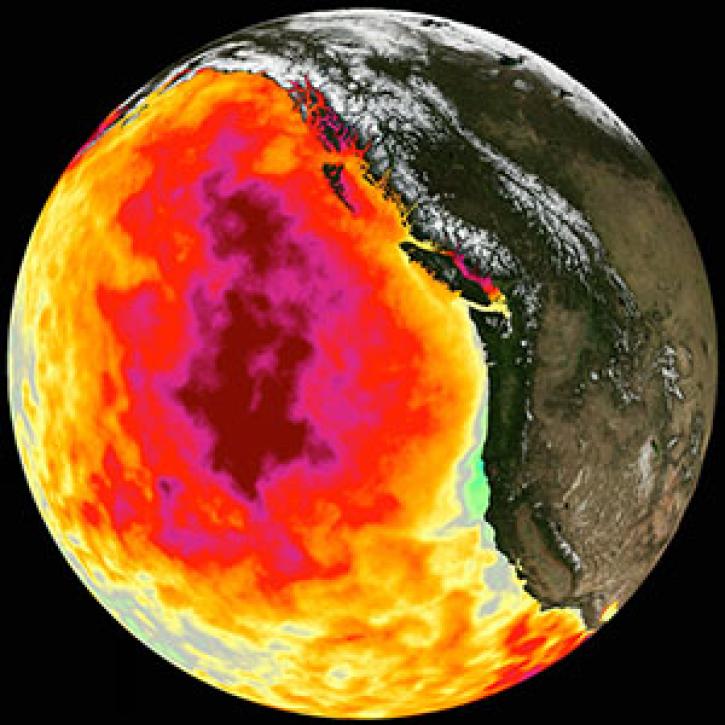
Too much warmth and too little wind fueled a massive marine heat wave along the Pacific Coast.
Feature Article
March 1, 2021

Who uses NASA Earth science data? Dr. John Wilkin, to study coastal ocean circulation, marine ecosystem processes, and the occasional rock lobster.
Data User Story
Dec. 22, 2020
SHOWING 4 OF 24
Frequently Asked Questions
Earthdata Forum
Our online forum provides a space for users to browse thousands of FAQs about research needs, data, and data applications. You can also submit new questions for our experts to answer.
Submit Questions to Earthdata Forumand View Expert Responses