We are in the process of migrating all NASA Earth science data sites into Earthdata from now until end of 2026. Not all NASA Earth science data and resources will appear here until then. Thank you for your patience as we make this transition.
Read about the Web Unification Project
Earthquakes Learning Resources
Webinars, tutorials, data recipes and more to help you work with Earthquakes.
Filters

This ARSET training introduces users to the characteristics and data of the NISAR mission and demonstrates workflows for accessing, visualizing, and analyzing the data for a range of applications.
Training
July 2-16, 2026
Esta capacitación de ARSET ofrece una introducción a la misión NISAR, enfocándose en las características de la misión y sus datos, así como en la demostración de flujos de trabajo para el acceso, la visualización y el análisis de datos para una variedad de aplicaciones.
Training
July 2-16, 2026

Learn more about the NASA Commercial Satellite Data Acquisition (CSDA) program vendor Umbra and how to discover, access, and work with their high-resolution commercial synthetic aperture radar (SAR) data products.
Webinar
Aug. 11, 2025

Learn more about the NASA Commercial Satellite Data Acquisition (CSDA) program vendor Capella Space and how to discover, access, and work with their SAR data products.
Webinar
Dec. 30, 2024
Learn how to use the GNSS-based Upper Atmospheric Realtime Disaster Information and Alert Network (GUARDIAN) ionospheric monitoring software to supplement early warning systems (EWS) detections of natural hazards such as tsunamis, volcanic eruptions, earthquakes, and geomagnetic and solar storms.
Webinar
Sept. 18, 2023
Join us Jan 25 at 2 p.m., ET [UTC -5], to learn how to use the Alaska Satellite Facility's OpenSARLab to work with synthetic aperture radar (SAR) data in the cloud.
Webinar
Jan. 10, 2023
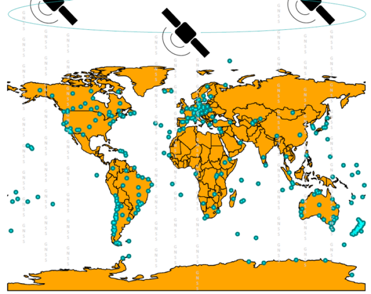
Join us on Sept. 28 to learn about the NASA Making Earth System Data Records (ESDR) for Use in Research Environments (MEaSUREs) Extended Solid Earth Science ESDR System (ESESES) project, whose Global Navigation Satellite System (GNSS)-derived data products enable research on tectonic motion, crustal deformation, earthquakes, tsunamis, sea level rise, extreme weather, and more!
Webinar
Sept. 8, 2022

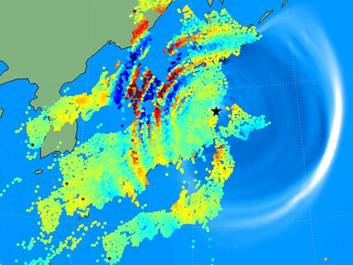
Read highlights of three publications that detail how NASA Earth observation data informs earthquake prediction, the effects of wildfires on vegetation, and the impact of agriculture on African birds.
Data in Action
July 19, 2021
SHOWING 8 OF 14
Frequently Asked Questions
Earthdata Forum
Our online forum provides a space for users to browse thousands of FAQs about research needs, data, and data applications. You can also submit new questions for our experts to answer.
Submit Questions to Earthdata Forumand View Expert Responses