We are in the process of migrating all NASA Earth science data sites into Earthdata from now until end of 2026. Not all NASA Earth science data and resources will appear here until then. Thank you for your patience as we make this transition.
Read about the Web Unification Project
Land Use/Land Cover News
Articles, resources, and announcements from Land Use/Land Cover.
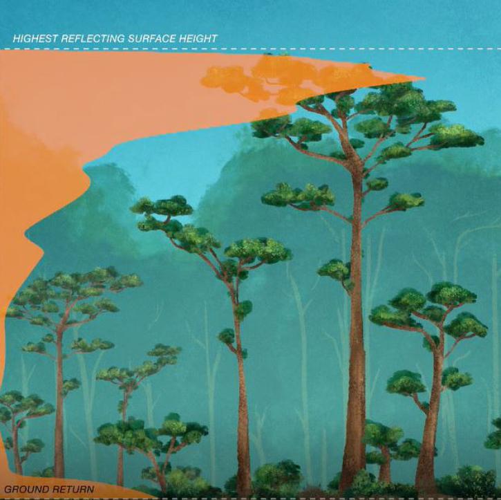
New dataset provides the first high-resolution 3D aboveground biomass density estimates for tropical and temperate forests around the globe.
Feature Article
Jan. 25, 2022

Satellites provide crucial information for researchers to monitor and help improve agricultural productivity in India.
Feature Article
Oct. 22, 2021

Dr. Hannah Kerner highlights the use of machine learning to address challenges in agriculture and food security through the use of remote sensing data.
Webinar
Aug. 12, 2021
The Methane Source Finder project mapped potential sources of methane in California and developed new technologies to make remote sensing data of methane emissions readily available.
Feature Article
June 17, 2021
SEDAC releases datasets showing impacts in patterns of socioeconomic development in the era of climate change.
News
June 16, 2021

The Harmonized Landsat Sentinel-2 (HLS) project offers daily, 30-meter global land surface data products to facilitate a wide range of terrestrial Earth science research.
Data User Story
June 15, 2021

Who uses NASA Earth science data? Dennis Ojima, to examine natural resource management response strategies to climate change in the North Central U.S.
Data User Story
April 22, 2021

Who uses NASA Earth science data? Dr. Nancy Glenn, to study dryland ecosystems.
Data User Story
April 22, 2021
SHOWING 8 OF 81