We are in the process of migrating all NASA Earth science data sites into Earthdata from now until end of 2026. Not all NASA Earth science data and resources will appear here until then. Thank you for your patience as we make this transition.
Read about the Web Unification Project
Sea Ice Data Access and Tools
NASA has sea ice datasets that help researchers characterize the presence and extent of ice in the ocean. Access a range of data and data tools such as AppEEARS, Worldview, and Giovanni to make the most of sea ice data.
Sea Ice Datasets
| Dataset Sort descending | Version | Platforms | Instruments | Temporal Extent | Spatial Extent | Spatial Resolution | Data Format |
|---|---|---|---|---|---|---|---|
| IceBridge L4 Sea Ice Freeboard, Snow Depth, and Thickness V001 | 1 | C-130, DC-8, P-3B | ATM, CAMBOT, DMS, SNOW RADAR | 2009-03-19 to 2013-04-25 |
N: 90 S: 60 E: 180 W: -180 N: -53 S: -90 E: 180 W: -180 |
XML, CSV | |
| IceBridge MCoRDS L1B Geolocated Radar Echo Strength Profiles V002 | 2 | BT-67, C-130, DC-8, G-V, NASA DC-8, NOAA Twin Otter, P-3B, WP-3D ORION | MCoRDS | 2009-10-16 to 2019-11-20 |
N: 83.1 S: 59 E: 28.5 W: -100.2 N: -57 S: -90 E: 180 W: -180 |
netCDF-4, JPEG | |
| IceBridge Merged Photon Counting Lidar/Profiler L4 Surface Slope and Elevations V001 | 1 | BT-67 | Sigma Space Lidar | 2010-11-25 to 2012-12-04 |
N: -53 S: -90 E: 180 W: -180 |
10 Meters x 10 Meters | HDF5 |
| IceBridge Narrow Swath ATM L1B Elevation and Return Strength with Waveforms V001 | 1 | C-130, DC-8, G-V, HU-25C, P-3B | ATM | 2017-10-29 to 2019-11-20 |
N: -53 S: -90 E: 180 W: -180 N: 90 S: 60 E: 180 W: -180 |
HDF5 | |
| IceBridge Narrow Swath ATM L1B Qfit Elevation and Return Strength V001 | 1 | DC-8, P-3B | ATM | 2011-03-16 to 2012-11-08 |
N: 90 S: 60 E: 180 W: -180 N: -53 S: -90 E: 180 W: -180 |
2 Meters x 2 Meters | Binary |
| IceBridge PARIS L2 Ice Thickness V001 | 1 | AIRCRAFT, P-3B | RADAR ECHO SOUNDERS, PARIS | 2009-04-01 to 2009-05-02 |
N: 84 S: 60 E: -11 W: -73 |
ASCII | |
| IceBridge Snow Radar L1B Geolocated Radar Echo Strength Profiles V002 | 2 | C-130, DC-8, DHC-3, G-V, P-3B, WP-3D ORION | SNOW RADAR | 2009-03-31 to 2021-05-13 |
N: -53 S: -90 E: 180 W: -180 N: 90 S: 60 E: 180 W: -180 |
netCDF-4, XML, JPEG | |
| IceBridge-Related DMS-Derived L4 Sea Ice Surface Cover Classification Images V001 | 1 | B-200, C-130, DC-8, HU-25A, HU-25C, P-3B, WP-3D ORION | DMS | 2010-03-23 to 2018-04-16 |
N: 90 S: 60 E: 180 W: -180 |
TIFF | |
| IceBridge-Related DMS-Derived L4 Sea Ice Surface Cover Classification Orthorectified Images V001 | 1 | C-130, DC-8, HU-25A, HU-25C, P-3B, WP-3D ORION | DMS | 2010-03-23 to 2017-07-25 |
N: 90 S: 60 E: 180 W: -180 |
TIFF | |
| ICESat L4 Seasonal Gridded Sea Ice Thickness V001 | 1 | ICESat | GLAS | 2003-02-20 to 2008-03-21 |
N: 86 S: 66 E: 180 W: -180 |
25 Kilometers x 25 Kilometers | netCDF-4, PNG |
SHOWING 10 OF 198
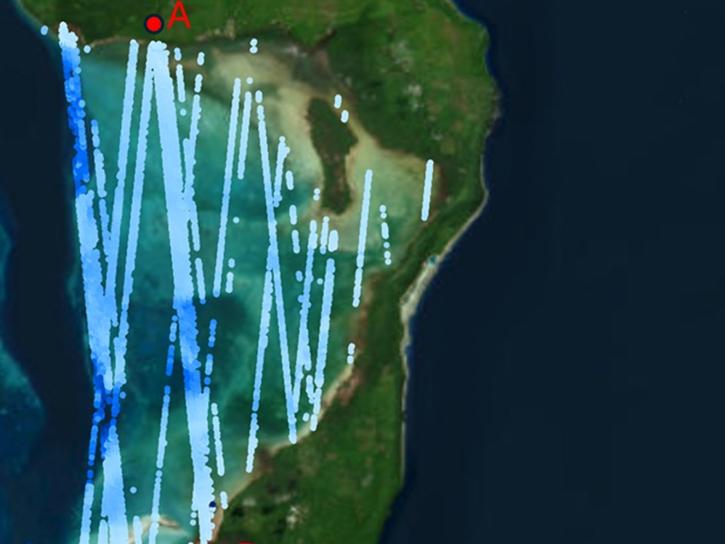
Featured Sea Ice Observation Method: ICESat-2
NASA's Ice, Cloud, and Land Elevation Satellite-2 (ICESat-2) carries a laser altimeter scientists use to measure the elevation of ice sheets, glaciers, sea ice, and more in unprecedented, 3-D detail. The satellite also measures heights across Earth's temperate and tropical regions, and takes stock of the vegetation in forests worldwide.

Data from NASA’s ICESat-2 mission provide incredibly accurate measurements of Earth elevation change—and much more.
8 MIN READ

The five new datasets are the result of a joint effort by NASA’s Satellite Needs Working Group Management Office (SNWG MO), ICESat-2 team, and Land, Atmosphere Near real-time Capability for EOS (LANCE).
3 MIN READ
ATL24, a new space-based lidar product, provides bathymetry data that can be used to characterize nearshore habitats and create safer maritime transportation channels.

This is the first in a five-part webinar series to introduce NASA's Ice, Cloud, and land Elevation-2 (ICESat-2) platform and the platform's data, tools, and applications.
Sea Ice Data Tools
| Tool Sort descending | Description | Services | |
|---|---|---|---|
| OpenAltimetry | OpenAltimetry is a map-based visualization tool for exploring surface elevation data across Earth over time. | Analysis, Search and Discovery, Visualization |
SHOWING 1 OF 1
Frequently Asked Questions
Earthdata Forum
Our online forum provides a space for users to browse thousands of FAQs about research needs, data, and data applications. You can also submit new questions for our experts to answer.
Submit Questions to Earthdata Forumand View Expert Responses