We are in the process of migrating all NASA Earth science data sites into Earthdata from now until end of 2026. Not all NASA Earth science data and resources will appear here until then. Thank you for your patience as we make this transition.
Read about the Web Unification Project
Filters

A summary of datasets, products, and resources released by NASA’s Distributed Active Archive Centers (DAACs) in August 2023.
News
Sept. 5, 2023
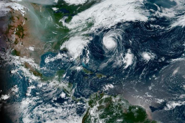
Image captured on Aug 30, 2023, by the ABI instrument aboard the GOES-East satellite.
Worldview Image of the Week
Aug. 31, 2023

Version 6 of the Advanced Very High Resolution Radiometer (AVHRR) Long-Term Data Record (LTDR) Products has been released by NASA's Level-1 and Atmosphere Archive and Distribution System Distributed Active Archive Center (LAADS DAAC).
News
Aug. 31, 2023

Data Rods for Hydrology offers easy access to time-series data for a point location.
Feature Article
Aug. 31, 2023

The Satellite Needs Working Group (SNWG) Portal provides easy access to SNWG-related data products.
News
Aug. 29, 2023
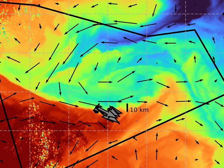
The S-MODE project combined airborne remote sensing and in-situ data to reveal upper-ocean dynamics and small-scale ocean features.
Data in Action
Aug. 29, 2023

For meteorologist David Peterson, Ozone Mapping and Profiler Suite (OMPS) data are crucial for studying pyrocumulonimbus events.
Data User Story
Aug. 28, 2023

Base image captured August 23, 2023, by the VIIRS instrument aboard the joint NASA/NOAA Suomi NPP satellite, overlaid with IMERG Precipitation Rate.
Worldview Image of the Week
Aug. 24, 2023
SHOWING 8 OF 2379