We are in the process of migrating all NASA Earth science data sites into Earthdata from now until end of 2026. Not all NASA Earth science data and resources will appear here until then. Thank you for your patience as we make this transition.
Read about the Web Unification Project
Filters

SWOT provides high-resolution data to help researchers monitor the vertical transport of heat and carbon within the ocean.
Data in Action
Sept. 15, 2023

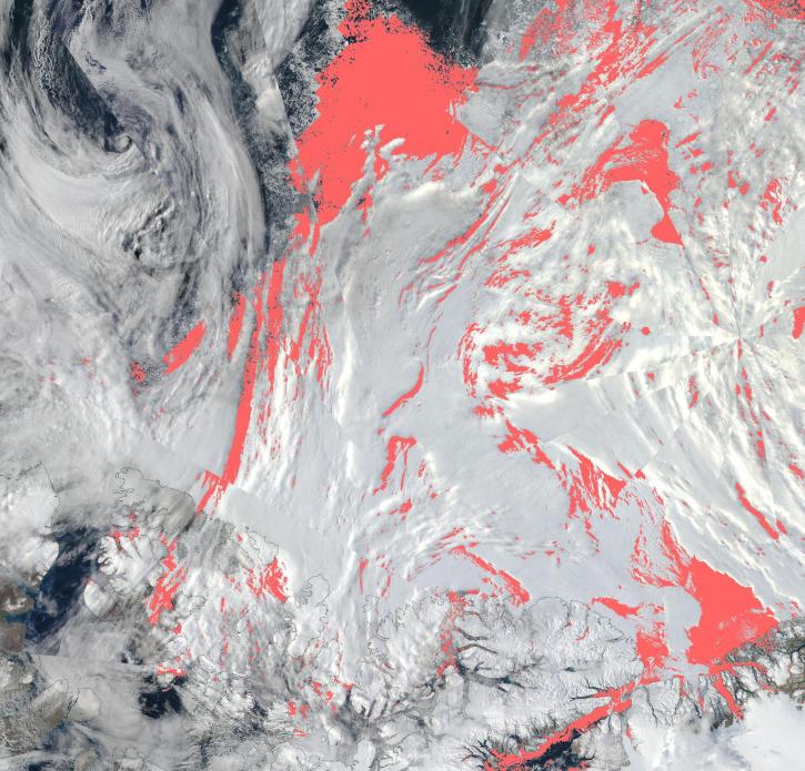
Image captured on Sep 13, 2023, by the VIIRS instrument aboard the joint NASA/NOAA Suomi NPP satellite.
Worldview Image of the Week
Sept. 14, 2023

The capability for others to embed Worldview into their own sites is back online.
Blog
Sept. 13, 2023
View a list of the layers that now show previously hidden pixel classifications.
Blog
Sept. 12, 2023

The new web address is part of the HiTIDE visualization tool's transition to the cloud.
News
Sept. 12, 2023

Base image acquired Sep 4, 2023, by the VIIRS instrument aboard the joint NASA/NOAA Suomi NPP satellite and overlaid with Aerosol Index values from the OMPS instrument.
Worldview Image of the Week
Sept. 7, 2023
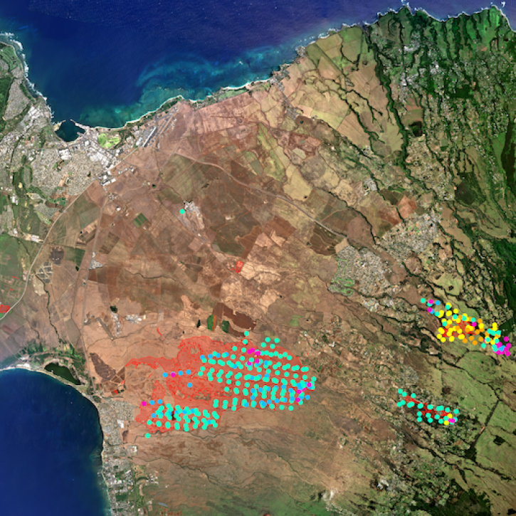
The project, described as a “breakthrough for fire mapping from space,” is producing high resolution maps to help guide post-fire recovery and remediation efforts.
News
Sept. 7, 2023
Users can now access the full Harmonized Landsat and Sentinel-2 (HLS) data archive back to April 2013.
News
Sept. 6, 2023
SHOWING 8 OF 2379