We are in the process of migrating all NASA Earth science data sites into Earthdata from now until end of 2026. Not all NASA Earth science data and resources will appear here until then. Thank you for your patience as we make this transition.
Read about the Web Unification Project
Filters

This data recipe demonstrates the basic concepts of S3 buckets using the Amazon S3 console.
Data Recipe
Oct. 18, 2024
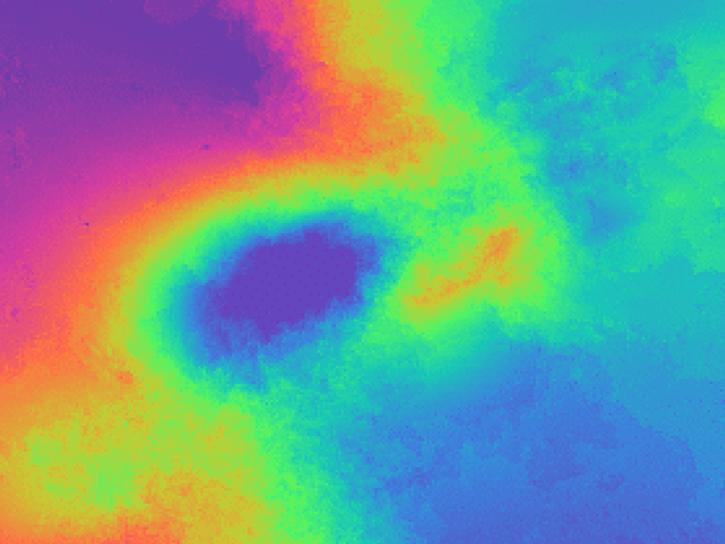
Learn how to phase unwrap an interferogram in this data recipe from NASA’s Alaska Satellite Facility Distributed Active Archive Center (ASF DAAC).
Data Recipe
Oct. 18, 2024
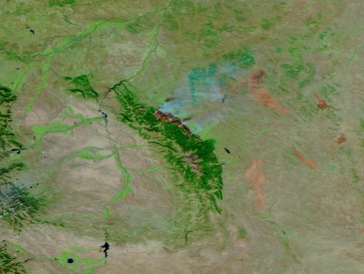
This image of the Elk Fire in Wyoming was captured on Oct 16, 2024, by the VIIRS instrument aboard the joint NASA/NOAA NOAA-21 platform.
Worldview Image of the Week
Oct. 17, 2024

This dataset identifies cloudy and clear-sky scenes to ensure long term, reliable measurements of the Earth system.
News
Oct. 16, 2024
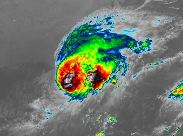
Image captured on Oct 10, 2024, at 8:00 p.m., EDT [00:00 UTC], by the Advanced Baseline Imager (ABI) instrument aboard the GOES-East platform.
Worldview Image of the Week
Oct. 10, 2024

The SWOT On-Demand Level 2 Raster Generation System (SWODLR) for Surface Water and Ocean Topography (SWOT) data is now part of Earthdata Search.
News
Oct. 9, 2024
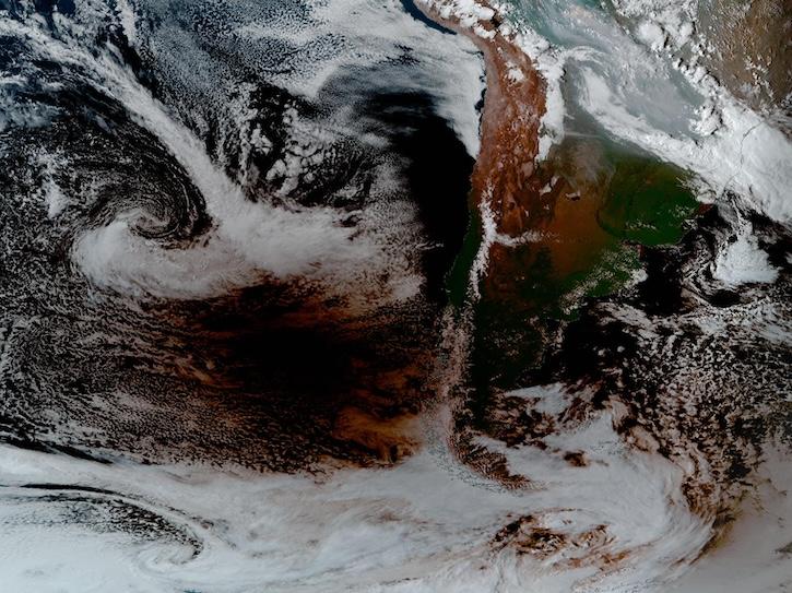
Image captured Oct 2, 2024, at 4:00 p.m., ET, by the Advanced Baseline Imager (ABI) instrument aboard the GOES-East platform.
Worldview Image of the Week
Oct. 3, 2024
A summary of datasets, products, and resources released by NASA’s Distributed Active Archive Centers (DAACs) in September 2024.
News
Oct. 3, 2024
SHOWING 8 OF 2379