We are in the process of migrating all NASA Earth science data sites into Earthdata from now until end of 2026. Not all NASA Earth science data and resources will appear here until then. Thank you for your patience as we make this transition.
Read about the Web Unification Project
Filters
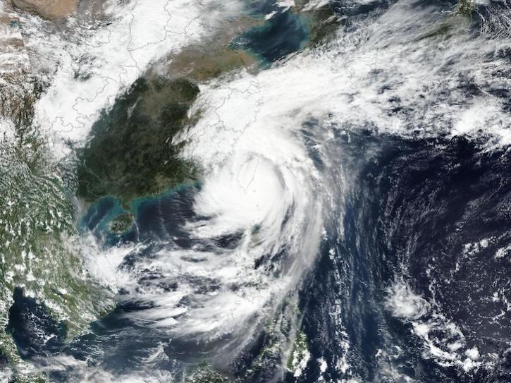
Image captured on Oct 31, 2024, by the VIIRS instrument aboard the joint NASA/NOAA Suomi NPP platform.
Worldview Image of the Week
Oct. 31, 2024
Interactive stories along with urban-relevant datasets are the latest updates to the portal.
News
Oct. 30, 2024

Sentinel-1 synthetic aperture radar (SAR) data are used to create maps of surface water extent for research, planning, and disaster response.
News
Oct. 28, 2024

This is the first in a five-part webinar series to introduce NASA's Ice, Cloud, and land Elevation-2 (ICESat-2) platform and the platform's data, tools, and applications.
Webinar
Oct. 28, 2024
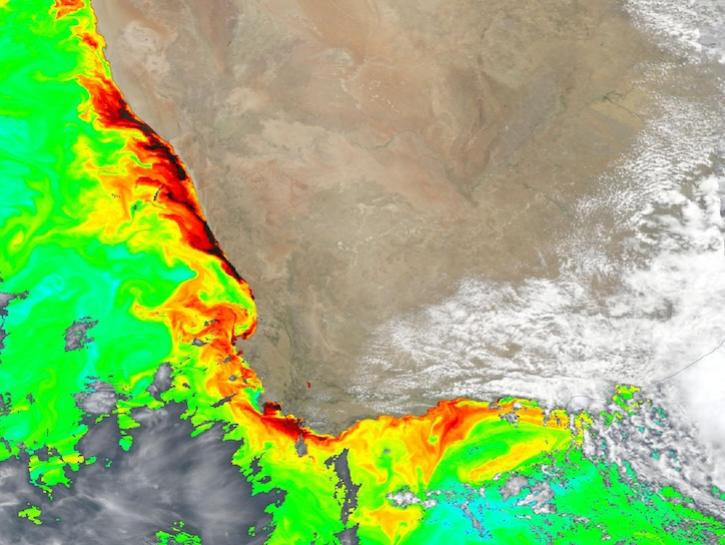
Dark colors indicate high chlorophyll concentrations in this image captured on Oct 22, 2024, by the Ocean Color Instrument (OCI) instrument.
Worldview Image of the Week
Oct. 25, 2024

Hydrocron, an API for time series retrievals of hydrology data products from the Surface Water and Ocean Topography (SWOT) mission, is now available.
News
Oct. 22, 2024

The life cycle of Earth observation data is rich and complex, with many points of entry along the pipeline. From collection to visualization, we dive deep into the basics to demystify the incredible data in our catalog.
Data Basics
Oct. 19, 2024
NASA Earth observation data are provided in different formats to meet varying user needs.
Data Basics
Oct. 18, 2024
SHOWING 8 OF 2379