We are in the process of migrating all NASA Earth science data sites into Earthdata from now until end of 2026. Not all NASA Earth science data and resources will appear here until then. Thank you for your patience as we make this transition.
Read about the Web Unification Project
Filters

Near real-time data products from the Ozone Mapping and Profiler Suite (OMPS) provide valuable information about atmospheric ozone and sulfur dioxide concentrations.
News
April 5, 2021
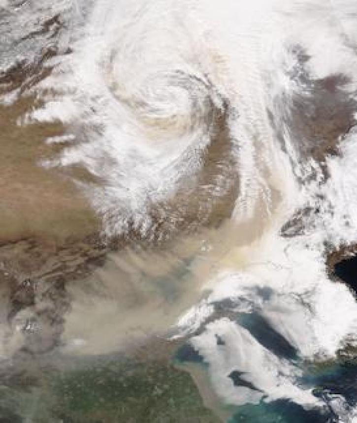
Image captured on 28 March 2021, by the VIIRS instrument, aboard the joint NASA/NOAA NOAA-20 satellite.
Worldview Image of the Week
April 5, 2021

We mourn the loss of Peter Fox, a leading proponent of the value of interdisciplinary scientific data stewardship.
News
April 2, 2021

This NASA-funded project supports researchers migrating workflows to the cloud using open, collaborative workflows.
Feature Article
April 1, 2021

A partnership between NASA's IMPACT and SpaceML led to the development of an open-source framework that simplifies the discovery of satellite imagery in NASA Worldview.
Feature Article
April 1, 2021
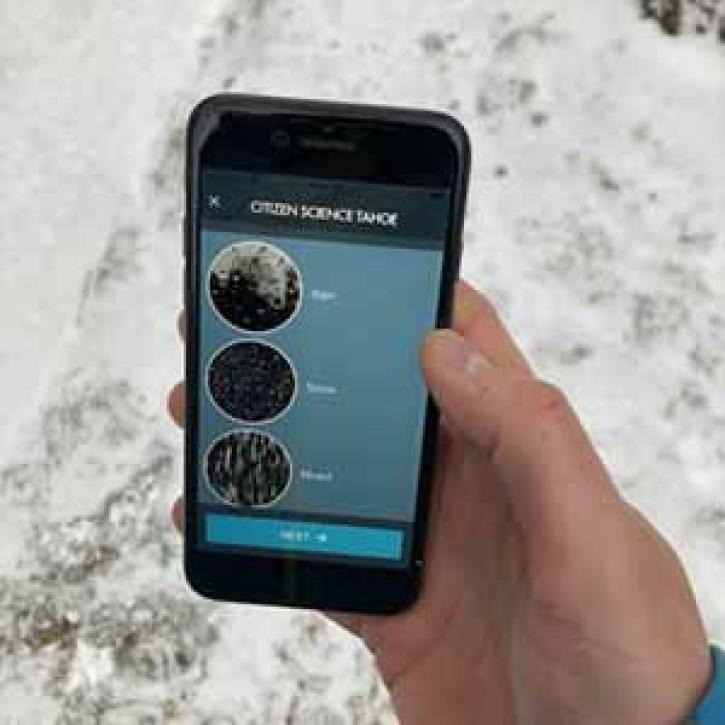
NASA’s Citizen Science for Earth Systems Program (CSESP) announces eight citizen science projects funded through the 2020 NASA Research Opportunities in Space and Earth Sciences (ROSES) solicitation.
Feature Article
April 1, 2021

A titan of the Earth and space science data community, Fox was recognized globally for his contributions and expertise.
Feature Article
April 1, 2021
Data access has changed over the years, and Dr. Josef Kellndorfer has played an integral role in the adoption of new technology.
Data User Story
April 1, 2021
SHOWING 8 OF 2379