We are in the process of migrating all NASA Earth science data sites into Earthdata from now until end of 2026. Not all NASA Earth science data and resources will appear here until then. Thank you for your patience as we make this transition.
Read about the Web Unification Project
Filters

Imagery of Earth at night provide unique opportunities for research. Dr. Miller uses these data in his studies of Earth’s nocturnal environment.
Data User Story
April 13, 2021

The Global Sea Level Change portal is NASA’s home for sea level change data and information. As the portal’s principal investigator, Dr. Boening ensures that it remains a key resource for both scientists and the general public.
Data User Story
April 12, 2021

The provisional public release of the Harmonized Landsat Sentinel-2 (HLS) dataset through NASA’s LP DAAC opens new avenues for global terrestrial research.
Feature Article
April 12, 2021
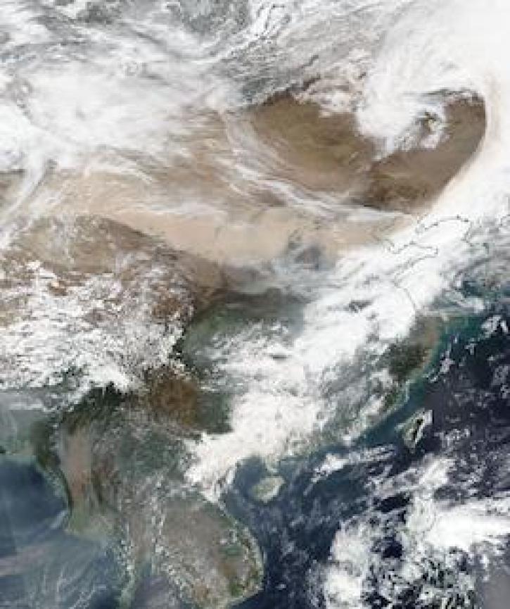
Image captured on 15 March 2021, by the VIIRS instrument, aboard the joint NASA/NOAA Suomi NPP satellite.
Worldview Image of the Week
April 12, 2021
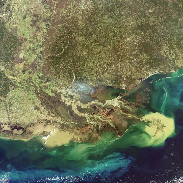
NASA researchers are using high resolution airborne data to determine the vulnerability and resilience of the Mississippi River Delta.
Feature Article
April 12, 2021
NASA’s Earth Science Division has selected 11 proposals for three-year awards through the 2019 Advancing Collaborative Connections for Earth System Science (ACCESS) Program solicitation. ACCESS is an Earth Science Data Systems (ESDS) competitive program that aims to improve and expand the use of NASA's Earth science data by leveraging modern techniques for managing and analyzing Earth science datasets. The selected proposals will develop technologies to effectively manage, discover, and use NASA’s quickly-growing archive of Earth observations.
Feature Article
April 9, 2021
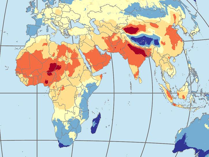
Two new datasets released by NASA's Socioeconomic Data and Applications Center provide key insights into human-environment interactions.
News
April 9, 2021
Learn how to produce global grids, how the grids incorporate remote sensing inputs, and how grids can be used in conjunction with other types of data.
News
April 7, 2021
SHOWING 8 OF 2379