We are in the process of migrating all NASA Earth science data sites into Earthdata from now until end of 2026. Not all NASA Earth science data and resources will appear here until then. Thank you for your patience as we make this transition.
Read about the Web Unification Project
Filters

50 years ago this October, the first successful Satellite Laser Range measurements were taken, ushering in a new era in the science of measuring the Earth’s exact shape, center of gravity, and precise rotation.
Feature Article
April 15, 2021

NASA’s worldwide Fire Information for Resource Management System (FIRMS) provides vital near real-time tools for managing wildland fires.
Feature Article
April 15, 2021

Researchers are using commercial, high-resolution imagery to map small-scale agriculture in Africa and Asia.
Feature Article
April 15, 2021
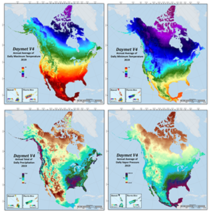
Daymet Version 4's improved algorithm and reduced timing and sensor biases result in more accurate and precise data.
News
April 14, 2021

Worldview and GIBS recently released new imagery in version 3.9.1 including MODIS Flood Product and CYGNSS Soil Moisture.
Blog
April 13, 2021

The 2020 release of the EPI ranks 180 countries in environmental health and ecosystem vitality based on 32 indicators.
News
April 13, 2021

A new Fire Information for Resource Management System (FIRMS) focused on the US and Canada provides expanded capabilities including additional map layers, ownership boundaries, and daily fire dangers.
News
April 13, 2021

Approximately one-third of Earth’s ice-free land surface is devoted to agriculture and livestock. Dr. Ramankutty uses Earth observing data to help find pathways to more sustainable agricultural practices.
Data User Story
April 13, 2021
SHOWING 8 OF 2379