We are in the process of migrating all NASA Earth science data sites into Earthdata from now until end of 2026. Not all NASA Earth science data and resources will appear here until then. Thank you for your patience as we make this transition.
Read about the Web Unification Project
Filters

Image captured on 7 March 2021, by the VIIRS instrument, aboard the joint NASA/NOAA Suomi NPP satellite.
Worldview Image of the Week
March 15, 2021

Learn how to build a tiny knowledge graph based on articles about scientific topics.
Webinar
March 11, 2021
Find EOSDIS dataset and data tool news, top stories, featured data images, webinars, links to new learning resources, data recipes, and Data User Profiles.
News
March 10, 2021
Image captured on February 16, 2021, by the VIIRS instrument, aboard the joint NASA/NOAA Suomi NPP platform.
Worldview Image of the Week
March 8, 2021

Image captured on 18 January 2021, by the VIIRS instrument, aboard the joint NASA/NOAA Suomi NPP satellite.
Worldview Image of the Week
March 8, 2021

NASA's Ocean Biology Distributed Active Archive Center has joined the Earthdata Forum, NASA's interactive platform that gives data users the chance to communicate with and learn from experts.
News
March 8, 2021

Image captured on 1 March 2021, by the MODIS instrument, aboard the Terra satellite.
Worldview Image of the Week
March 8, 2021
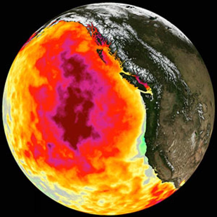
Too much warmth and too little wind fueled a massive marine heat wave along the Pacific Coast.
Feature Article
March 1, 2021
SHOWING 8 OF 2379