We are in the process of migrating all NASA Earth science data sites into Earthdata from now until end of 2026. Not all NASA Earth science data and resources will appear here until then. Thank you for your patience as we make this transition.
Read about the Web Unification Project
Filters

Image captured on Aug 8, 2022, by the MODIS instrument aboard the Terra satellite.
Worldview Image of the Week
Aug. 9, 2022

NASA's EMIT instrument captured its first light image as it passed over Western Australia on July 27, 2022.
News
Aug. 4, 2022
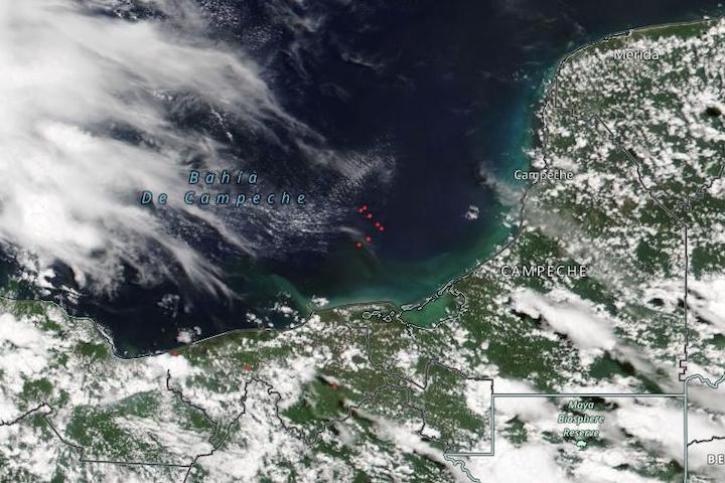
Image captured on Aug 1, 2022, by the VIIRS instrument aboard the joint NASA/NOAA NOAA-20 satellite.
Worldview Image of the Week
Aug. 2, 2022

Ryan Boller, ESDIS Data Visualization Lead, plays a key role in the development of NASA’s Global Imagery Browse Services and Worldview.
Data User Story
July 29, 2022

Data from NASA’s ASF DAAC helps scientists like Dr. Zhong Lu develop satellite radar remote-sensing techniques for studying geohazards.
Data User Story
July 28, 2022

Image captured on Jul 26, 2022 by the MODIS instrument aboard the Aqua satellite.
Worldview Image of the Week
July 26, 2022

Learn how to change the colors of the fires/thermal anomalies, change the fire pixel size, show only day or night detections, and color code fires by fire radiative power, confidence, or time since detection.
Blog
July 24, 2022

Scientists develop routine service for wildfire detection in the continental United States with a latency of less than 60 seconds.
Feature Article
July 20, 2022
SHOWING 8 OF 2379