We are in the process of migrating all NASA Earth science data sites into Earthdata from now until end of 2026. Not all NASA Earth science data and resources will appear here until then. Thank you for your patience as we make this transition.
Read about the Web Unification Project
Filters
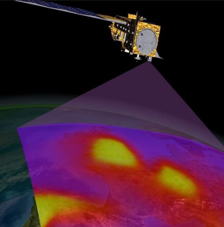
Data from the next-generation Instruments will help atmospheric scientists advance air quality measurements and standards.
Feature Article
Nov. 2, 2022

Image captured on Nov 1, 2022 by the VIIRS instrument aboard the joint NASA/NOAA Suomi NPP satellite.
Worldview Image of the Week
Nov. 1, 2022

Significant bias found in CLIMCAPS Processing System Derived Carbon Monoxide Mass Mixing Ratio dataset.
News
Oct. 31, 2022

Thirty-meter data from the Operational Land Imager aboard Landsat 8 and 9 offer greater resolution than MODIS and VIIRS.
Feature Article
Oct. 31, 2022
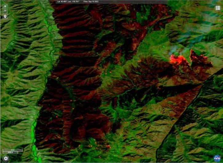
This new near real-time Landsat Fire and Thermal Anomaly active fire product is the result of an ongoing collaboration by NASA LANCE/FIRMS, University of Maryland, USDA Forest Service, and USGS EROS Data Center.
Blog
Oct. 31, 2022

Terra imagery has resumed production.
Blog
Oct. 28, 2022

Data from NASA’s GES DISC help scientists like Dr. William Blackwell study the thermodynamics of tropical cyclones.
Data User Story
Oct. 27, 2022

Join us on October 26-27, 2022, for the Data Workshop for Investigation of Microphysics and Precipitation for Atlantic Coast-Threatening Snowstorms (IMPACTS).
Event
Oct. 26, 2022
SHOWING 8 OF 2379