We are in the process of migrating all NASA Earth science data sites into Earthdata from now until end of 2026. Not all NASA Earth science data and resources will appear here until then. Thank you for your patience as we make this transition.
Read about the Web Unification Project
Filters

Work by five Science Investigator-led Processing Systems (SIPS) enhance data continuity for next-generation instruments and missions.
Feature Article
Nov. 14, 2022
As EOSDIS System Manager and LANCE Manager, Karen Michael has two roles, but has one mission: ensuring users get the data they need.
Data User Story
Nov. 10, 2022

Image captured on Nov 4, 2022, by the MSI instrument aboard the ESA (European Space Agency) Sentinel-2A and -2B satellites.
Worldview Image of the Week
Nov. 8, 2022

Worldview now provides the ability to view multiple event tracks on the map, specifically for "Severe Storm" and "Sea and Lake Ice" events.
Blog
Nov. 7, 2022
Worldview has been working to increase the usability and visibility of its features to help users accomplish their goals.
Blog
Nov. 7, 2022
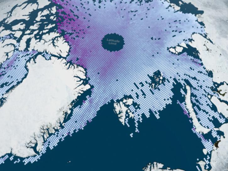
Join the NASA Ice, Cloud and land Elevation Satellite-2 (ICESat-2) Applications Team on Nov 16, 2022, for the ICESat-2 Atmospheric Applications and Forging Multi-mission Solutions Focus Session.
News
Nov. 7, 2022

The ACTIVATE team hosted three open data workshops/webinars in 2022 in July, September, and November.
Event
Nov. 7, 2022
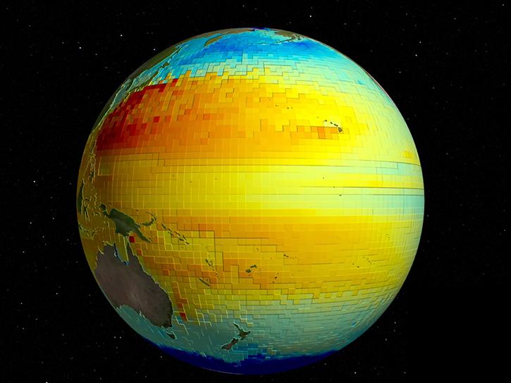
SWOT and ECCO can measure sea surface height at different resolutions for monitoring the ocean's vertical heat, carbon transport, and other processes.
Data in Action
Nov. 2, 2022
SHOWING 8 OF 2379