We are in the process of migrating all NASA Earth science data sites into Earthdata from now until end of 2026. Not all NASA Earth science data and resources will appear here until then. Thank you for your patience as we make this transition.
Read about the Web Unification Project
Filters
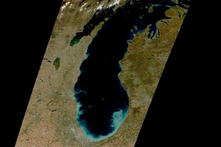
Image captured on Oct 22, 2022 by the MSI instrument aboard the ESA (European Space Agency) Sentinel-2A and -2B satellites.
Worldview Image of the Week
Oct. 25, 2022
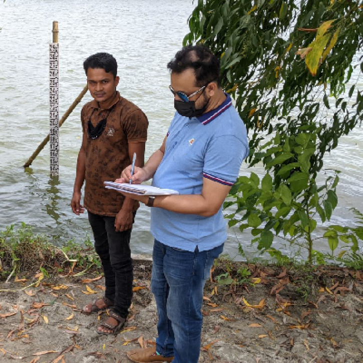
NASA satellite data and citizen scientists are giving the Bangladesh government a better understanding of the country's surface water storage.
Feature Article
Oct. 19, 2022
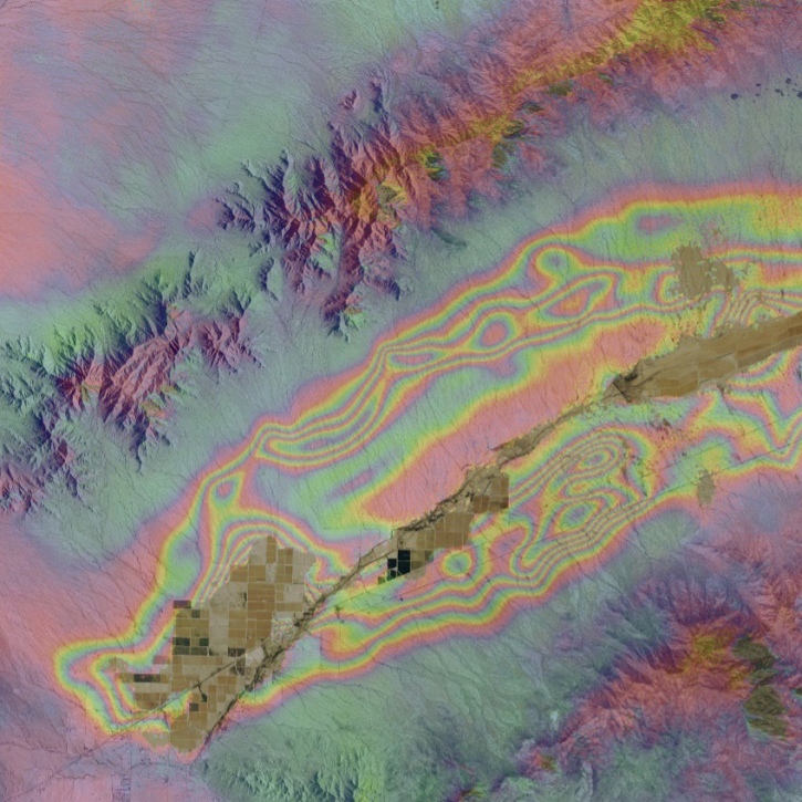
When the Arizona Department of Water Resources lost valuable synthetic aperture radar (SAR) data, OpenSARLab provided a solution.
Feature Article
Oct. 18, 2022

The contract extension continues granting access to Planet data to more than 300,000 U.S. scientists and researchers.
News
Oct. 17, 2022

Image captured on Oct 16, 2022, by the MODIS instrument aboard NASA's Aqua satellite.
Worldview Image of the Week
Oct. 17, 2022

The Multi-angle Imaging SpectroRadiometer (MISR) captured an optical image of Hurricane Ian, Sept. 27, 2022.
News
Oct. 14, 2022

NASA’s Aerosol Cloud meTeorology Interactions oVer the western ATlantic Experiment (ACTIVATE) team is hosting a free open data workshop on Nov 7 as part of its annual science team meeting scheduled for Nov 7-9, 2022 at the University of Arizona (Tucson, Arizona).
News
Oct. 13, 2022
The data are part of ongoing efforts by NASA's Commercial SmallSat Data Acquisition (CSDA) program to acquire commercial SmallSat data.
Feature Article
Oct. 12, 2022
SHOWING 8 OF 2379