We are in the process of migrating all NASA Earth science data sites into Earthdata from now until end of 2026. Not all NASA Earth science data and resources will appear here until then. Thank you for your patience as we make this transition.
Read about the Web Unification Project
Filters
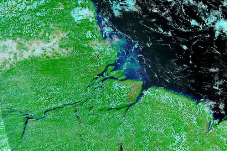
Image captured on Nov 21, 2022, by the VIIRS instrument aboard the joint NASA/NOAA NOAA-20 satellite.
Worldview Image of the Week
Nov. 22, 2022

NASA’s GHRC DAAC helps scientists like Dr. Timothy Lang use lightning data to better understand the processes in convective storms.
Data User Story
Nov. 21, 2022

This demonstrates how to ingest FIRMS fire data provided as Web Feature Services (WFS) into ArcGIS Online (New Map Viewer and Map Viewer Classic).
Tutorial
Nov. 20, 2022

This virtual, open community forum on Dec 8, 2022, features discussions of Terra instrument and spacecraft health, mission longevity, and prospective scientific impacts, data product implications, and opportunities resulting from past and future orbit changes.
Event
Nov. 17, 2022

NASA Earth science data are being used in Africa’s Sahel region and across the continent to help track, study, and manage fires.
Feature Article
Nov. 16, 2022
Geographic Information Systems (GIS) provide powerful capabilities for visualizing, analyzing, and interacting with Earth science data.
News
Nov. 16, 2022

Image captured on Nov 9, 2022, by the MSI instrument aboard the ESA (European Space Agency) Sentinel-2A and -2B satellites.
Worldview Image of the Week
Nov. 15, 2022
SHOWING 8 OF 2379