We are in the process of migrating all NASA Earth science data sites into Earthdata from now until end of 2026. Not all NASA Earth science data and resources will appear here until then. Thank you for your patience as we make this transition.
Read about the Web Unification Project
Terra Resources
Documents
| Name Sort descending | Description | File Type | Date Published | |
|---|---|---|---|---|
| MODIS Terra/Aqua | MODIS Terra/Aqua | PDF (155.7 kb) | April 19, 2004 | |
| Multi-angle Imaging SpectroRadiometer (MISR) Overview | PDF (149.95 kb) | Feb. 24, 2021 | ||
| NASA Support for MODIS Direct Broadcast:Level-0 to Standard Ocean Products (PDF) | NASA Support for MODIS Direct Broadcast:Level-0 to Standard Ocean Products (PDF) | PDF (4.3 mb) | Oct. 3, 2005 | |
| NASA Support for MODIS Direct Broadcast:Level-0 to Standard Ocean Products (PPT) | NASA Support for MODIS Direct Broadcast:Level-0 to Standard Ocean Products (PPT) | PPT (4.62 mb) | Jan. 21, 2005 | |
| NASA/TM–2003–206892, Vol. 27 | NASA/TM–2003–206892, Vol. 27 | PDF (1.71 mb) | Oct. 14, 2003 |
SHOWING 5 OF 60
Terra Learning Resources

Explore sea surface temperature anomalies in the Gulf of America before, during, and after Tropical Cyclones Laura and Marco with NASA's MUR SST dataset.
Data in Action
Sept. 10, 2020

Esta formación ARSET abarca algunas de las dificultades asociadas a la teledetección de los ecosistemas costeros.
Training
Aug. 25 - Sept. 8, 2020
This ARSET training covers some of the difficulties associated with remote sensing of coastal ecosystems.
Training
Aug. 25 - Sept. 8, 2020

Learn how NASA data shed light on heat wave-related deaths, informed machine learning regression models predicting honey harvests, and mapped maize crops.
Data in Action
Aug. 24, 2020

This ArcGIS Python Toolbox simplifies access to quality data by decoding complex quality information into usable thematic raster files.
Tutorial
Aug. 18, 2020

NASA's Land Processes Distributed Active Archive Center (LP DAAC) provides an introduction to learning resources for the ecology community.
Webinar
Aug. 6, 2020
In response to the Deepwater Horizon oil spill, researchers used a machine learning algorithm to classify oil thickness with Terra ASTER data.
Data in Action
July 23, 2020

This ARSET training teaches how to use earth observations to estimate water budgets for a given river basin.
Training
July 21 - Aug. 4, 2020
SHOWING 8 OF 231
Terra News
View All News
Filters

Image of a three-day flood composite ending Mar 22, 2023, from the MODIS instruments aboard the Terra and Aqua satellites, overlaid on a true color corrected reflectance image.
Worldview Image of the Week
March 22, 2023

A new Request for Information (RFI) with responses due by April 4 seeks input for determining Terra, Aqua, and Aura mission data product continuity needs, capabilities, and gaps.
News
March 6, 2023
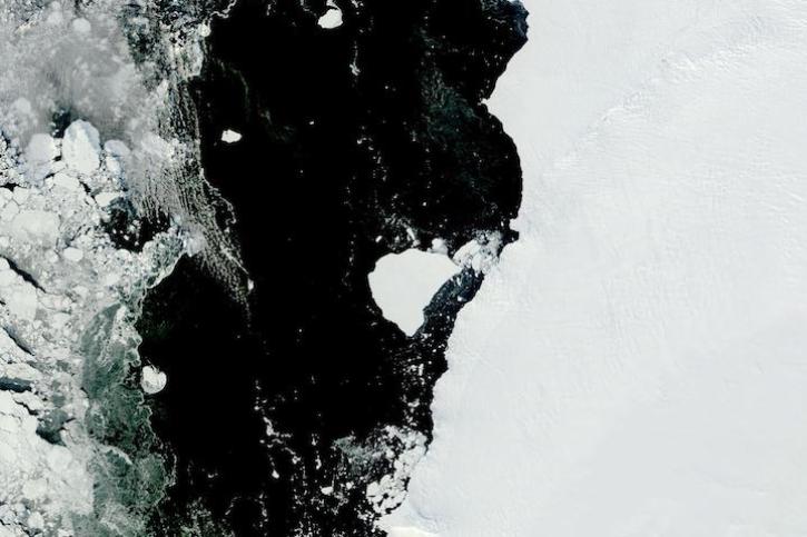
Image captured on Feb 28, 2023, by the MODIS instrument aboard NASA's Terra satellite.
Worldview Image of the Week
March 1, 2023

Data from NASA’s ORNL DAAC help Dr. Kyla Dahlin better understand how remote sensing can improve predictive ecological models.
Data User Story
Feb. 28, 2023
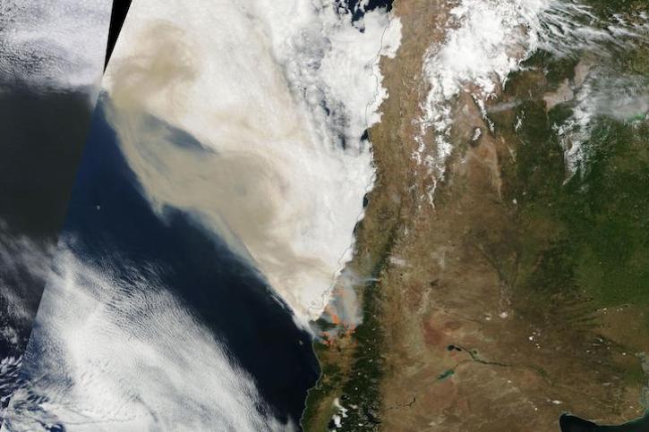
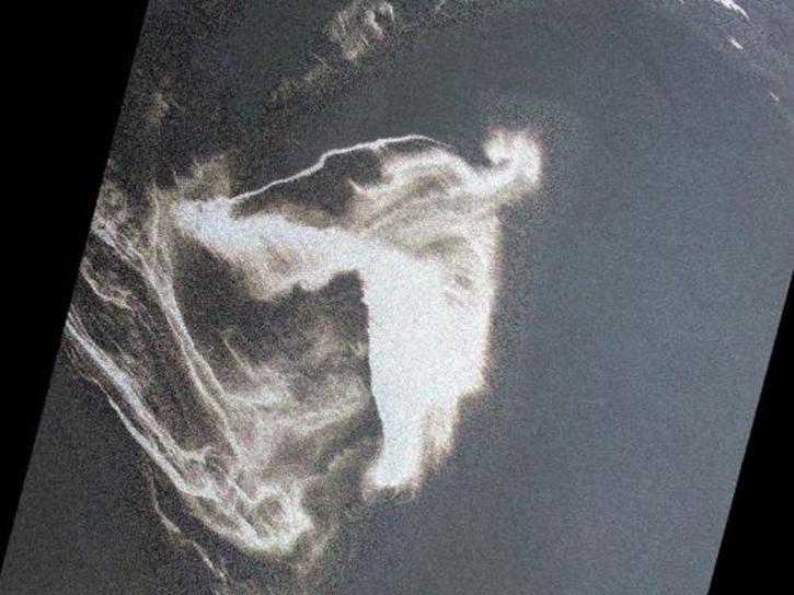
Image captured on Feb 4, 2023, by the MODIS instrument aboard NASA's Terra satellite.
Worldview Image of the Week
Feb. 7, 2023

NASA near real-time data help Lori Schultz respond to agencies that reach out to NASA in the wake of natural disasters.
Data User Story
Jan. 31, 2023

MODIS V6 land data products suffer from known calibration issues discovered after the completion of V6 reprocessing.
News
Jan. 30, 2023

Image of a three-day flood composite ending Jan 23, 2023, from the MODIS instruments aboard the Terra and Aqua satellites.
Worldview Image of the Week
Jan. 24, 2023
SHOWING 8 OF 449
Frequently Asked Questions
Earthdata Forum
Our online forum provides a space for users to browse thousands of FAQs about research needs, data, and data applications. You can also submit new questions for our experts to answer.
Submit Questions to Earthdata Forumand View Expert Responses