We are in the process of migrating all NASA Earth science data sites into Earthdata from now until end of 2026. Not all NASA Earth science data and resources will appear here until then. Thank you for your patience as we make this transition.
Read about the Web Unification Project
QuikSCAT Resources
QuikSCAT Learning Resources

NASA's OSCAR data were used to analyze ocean currents to track debris fields for Malaysian Airlines flight 370.
Data in Action
April 4, 2014

NASA satellites and instruments provide global wave height observations and ocean vector winds on a daily basis.
Data in Action
Jan. 14, 2014
SHOWING 2 OF 2
QuikSCAT News
View All News
Filters
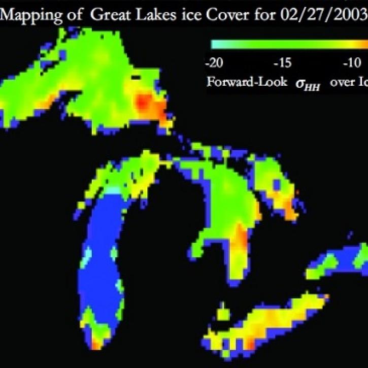
Understanding Great Lakes ice means enduring some tough conditions.
Feature Article
June 2, 2023

Who uses NASA Earth science data? Deborah Balk, to create new, demographically informed methods to forecast city growth.
Data User Story
April 22, 2021

Who uses NASA Earth science data? Dr. Karen Seto, to study the environmental effects of urbanization.
Data User Story
April 22, 2021

Who uses NASA Earth science data? Dr. Larry O’Neill, to explore the effects of air-sea interactions on weather, ocean, and climate.
Data User Story
April 22, 2021

Satellite data help sea-going oceanographers pursue an elusive ocean layer.
Feature Article
Dec. 28, 2020
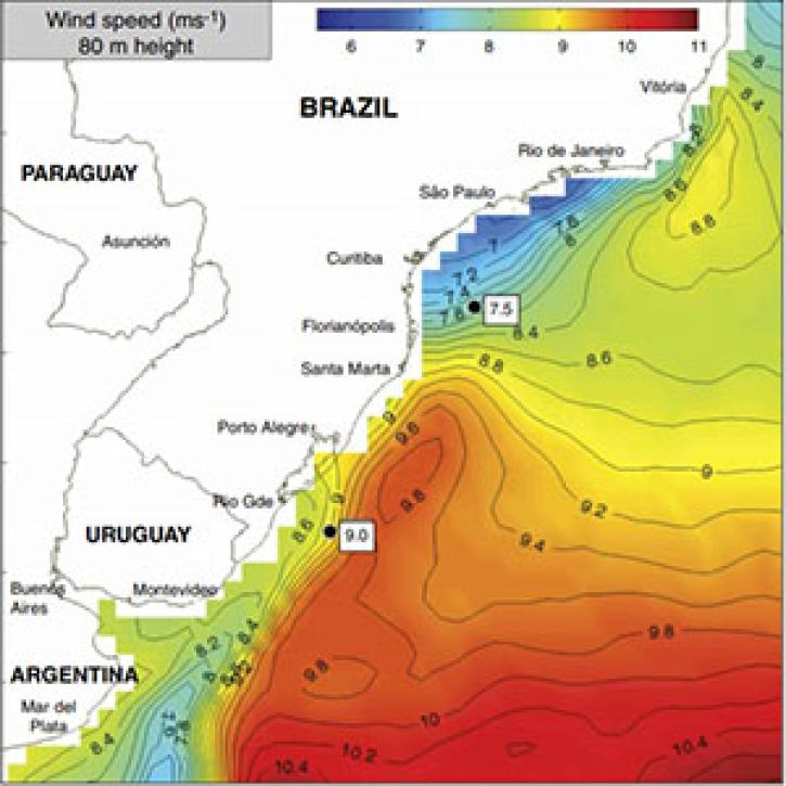
Researchers discover that coastal winds could help change Brazil's energy portfolio.
Feature Article
Dec. 28, 2020

Invisible pollutants lurk under Italy’s most populous valley.
Feature Article
Dec. 28, 2020

Who uses NASA Earth science data? Dr. Joan Ramage, to study glaciers and snowmelt.
Data User Story
Dec. 22, 2020
SHOWING 8 OF 14
Frequently Asked Questions
Earthdata Forum
Our online forum provides a space for users to browse thousands of FAQs about research needs, data, and data applications. You can also submit new questions for our experts to answer.
Submit Questions to Earthdata Forumand View Expert Responses