We are in the process of migrating all NASA Earth science data sites into Earthdata from now until end of 2026. Not all NASA Earth science data and resources will appear here until then. Thank you for your patience as we make this transition.
Read about the Web Unification Project
ASF DAAC Learning Resources
Webinars, tutorials, data recipes and more to help you work with ASF DAAC.
Filters
Learn how to view Seasat HDF5 files in Alaska Satellite Facility Distributed Active Archive Center (ASF DAAC) MapReady in this NASA data recipe.
Data Recipe
May 20, 2020

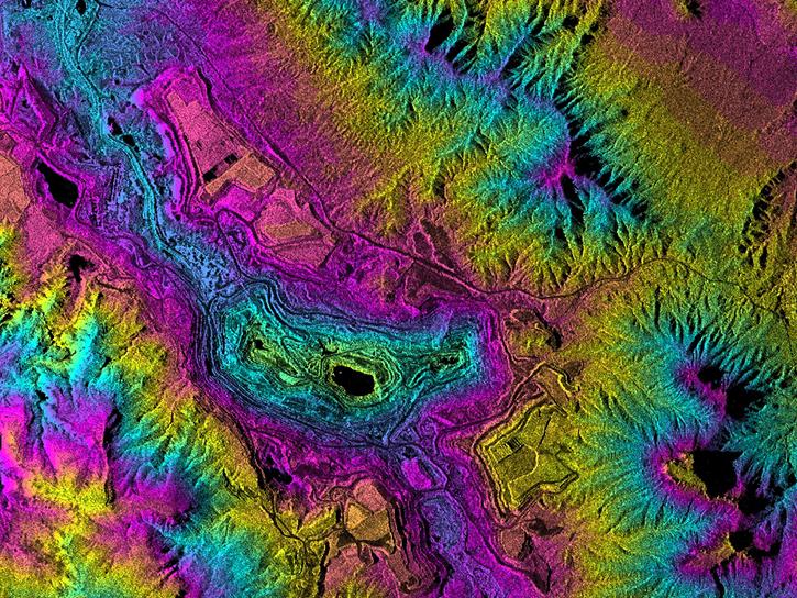
This ARSET training focuses on using interferometric synthetic aperture radar for characterizing landslides and generating a digital elevation model.
Training
Dec. 3-5, 2019
Esta capacitación de ARSET cubre el uso de SAR interferométrico para caracterizar deslizamientos y generar modelos de elevación digitales.
Training
Dec. 3-5, 2019

Esta capacitación de ARSET se enfoca en aplicaciones agrícolas y de inundaciones usando datos de radar de apertura sintética (SAR).
Training
Aug. 28 - Sept. 4, 2019
This ARSET training focuses on agriculture and flood applications of synthetic aperture radar (SAR) data.
Training
Aug. 28 - Sept. 4, 2019

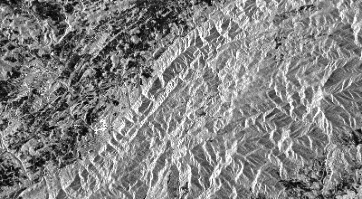
This data recipe walks users through the Offset Tracking tools to generate glacier velocity maps with Sentinel-1 Level-1 Ground Range Detected products.
Data Recipe
Feb. 18, 2019
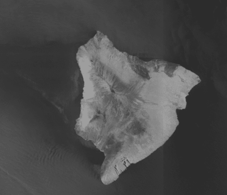
This data recipe identifies how to view and geocode CEOS format files using ASF’s MapReady software.
Data Recipe
Nov. 9, 2018
This recipe will go over the basic steps to get started in the Sentinel-1 Toolbox and to create a subset of your desired area of study.
Data Recipe
Oct. 18, 2018
SHOWING 8 OF 126