| Ground-Based GNSS-based Upper Atmospheric Realtime Disaster Information and Alert Network (GUARDIAN) GLONASS daily accumulated real-time Precise Orbit Determination (POD) Clock Corrections (1-second sampling, 24-hour files) from NASA CDDIS |
1 |
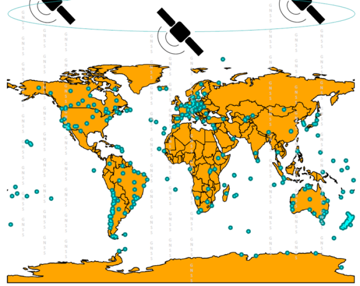
GLONASS, GROUND STATIONS |
GNSS RECEIVER |
2023-10-01 |
N: 90
S: -90
E: 180
W: -180
|
|
JPL Time Dependent Parameter (ASCII) |
| Ground-Based GNSS-based Upper Atmospheric Realtime Disaster Information and Alert Network (GUARDIAN) GLONASS daily accumulated real-time Precise Orbit Determination (POD) Clock Corrections (60-second sampling, 24-hour files) from NASA CDDIS |
1 |
GLONASS, GROUND STATIONS |
GNSS RECEIVER |
2023-10-01 |
N: 90
S: -90
E: 180
W: -180
|
|
JPL Time Dependent Parameter (ASCII) |
| Ground-Based GNSS-based Upper Atmospheric Realtime Disaster Information and Alert Network (GUARDIAN) GLONASS daily accumulated real-time Precise Orbit Determination (POD) orbits (60-second sampling, 24-hour files) from NASA CDDIS |
1 |
GPS, GROUND STATIONS |
|
2023-10-01 |
N: 90
S: -90
E: 180
W: -180
|
|
JPL pos-GOA (ASCII) |
| Ground-Based GNSS-based Upper Atmospheric Realtime Disaster Information and Alert Network (GUARDIAN) GPS daily accumulated real-time Precise Orbit Determination (POD) Attitude Quaternions (30-second sampling, 24-hour files) from NASA CDDIS |
1 |
GPS, GROUND STATIONS |
|
2023-10-01 |
N: 90
S: -90
E: 180
W: -180
|
|
JPL Quaternions (ASCII) |
| Ground-Based GNSS-based Upper Atmospheric Realtime Disaster Information and Alert Network (GUARDIAN) GPS daily accumulated real-time Precise Orbit Determination (POD) Clock Corrections (1-second sampling, 24-hour files) from NASA CDDIS |
1 |
GPS, GROUND STATIONS |
|
2023-10-01 |
N: 90
S: -90
E: 180
W: -180
|
|
JPL Time Dependent Parameter (ASCII) |
| Ground-Based GNSS-based Upper Atmospheric Realtime Disaster Information and Alert Network (GUARDIAN) GPS daily accumulated real-time Precise Orbit Determination (POD) Clock Corrections (60-second sampling, 24-hour files) from NASA CDDIS |
1 |
GPS, GROUND STATIONS |
|
2023-10-01 |
N: 90
S: -90
E: 180
W: -180
|
|
JPL Time Dependent Parameter (ASCII) |
| Ground-Based GNSS-based Upper Atmospheric Realtime Disaster Information and Alert Network (GUARDIAN) GPS daily accumulated real-time Precise Orbit Determination (POD) orbits (60-second sampling, 24-hour files) from NASA CDDIS |
1 |
GPS, GROUND STATIONS |
|
2023-10-01 |
N: 90
S: -90
E: 180
W: -180
|
|
JPL pos-GOA (ASCII) |
| Ground-Based Meteorological Data (daily, 24 hour files) from Co-Located Global Navigation Satellite System (GNSS) Receivers from NASA CDDIS |
1 |
Beidou, Galileo, GLONASS, GPS, GROUND STATIONS, QZSS, IRNSS, SBAS |
Beidou P, Galileo P, GLONASS P, GPSP, GNSS RECEIVERS, QZSS P, IRNSS P, SBAS P |
1992-01-01 to Present |
N: 90
S: -90
E: 180
W: -180
|
|
RINEX |
| Ground-Based Meteorological Data (daily, 24 hour files) from Co-Located Ground-Based Global Navigation Satellite System GLONASS (GLObal NAvigation Satellite System) Receivers from NASA CDDIS |
1 |
GLONASS, GROUND STATIONS |
GLONASS P, GNSS RECEIVER |
1998-01-01 to Present |
N: 90
S: -90
E: 180
W: -180
|
|
RINEX |
| Ground-Based Satellite Laser Ranging (SLR) Observation Data (full-rate, daily, 24 hour files) from NASA CDDIS |
1 |
LAGEOS-1, LAGEOS-2, ETALON-1, ETALON-2, GROUND STATIONS, AJISAI, STARLETTE, STELLA, Galileo, GLONASS, Beidou, IRNSS, QZSS, LARES |
LASER REFLECTOR, SLR Station |
1976-01-01 to Present |
N: 90
S: -90
E: 180
W: -180
|
|
ILRS data format, CRD format |
| Ground-Based Satellite Laser Ranging (SLR) Observation Data (full-rate, monthly files) from NASA CDDIS |
1 |
LAGEOS-1, LAGEOS-2, ETALON-1, ETALON-2, GROUND STATIONS, AJISAI, STARLETTE, STELLA, Galileo, GLONASS, Beidou, IRNSS, QZSS, LARES |
LASER REFLECTOR, SLR Station |
1976-01-01 to Present |
N: 90
S: -90
E: 180
W: -180
|
|
ILRS data format, CRD format |
| Ground-Based Satellite Laser Ranging (SLR) Observation Data (normal points, daily, 24 hour files) from NASA CDDIS |
1 |
LAGEOS-1, LAGEOS-2, ETALON-1, ETALON-2, GROUND STATIONS, AJISAI, STARLETTE, STELLA, Galileo, GLONASS, Beidou, IRNSS, QZSS, LARES |
LASER REFLECTOR, SLR Station |
2016-01-01 to Present |
N: 90
S: -90
E: 180
W: -180
|
|
ILRS data format, CRD format |
| Ground-Based Satellite Laser Ranging (SLR) Observation Data (normal points, hourly files) from NASA CDDIS |
1 |
LAGEOS-1, LAGEOS-2, ETALON-1, ETALON-2, GROUND STATIONS, AJISAI, STARLETTE, STELLA, Galileo, GLONASS, Beidou, IRNSS, QZSS, LARES |
LASER REFLECTOR, SLR Station |
2010-01-01 to Present |
N: 90
S: -90
E: 180
W: -180
|
|
ILRS data format, CRD format |
| Ground-Based Satellite Laser Ranging (SLR) Observation Data (normal points, monthly files) from NASA CDDIS |
1 |
LAGEOS-1, LAGEOS-2, ETALON-1, ETALON-2, GROUND STATIONS, AJISAI, STARLETTE, STELLA, Galileo, GLONASS, Beidou, IRNSS, QZSS, LARES |
LASER REFLECTOR, SLR Station |
1982-01-01 to Present |
N: 90
S: -90
E: 180
W: -180
|
|
ILRS data format, CRD format |
| Ground-Based Satellite Laser Ranging (SLR) Observation Data Summary (normal points, monthly files) from NASA CDDIS |
1 |
LAGEOS-1, LAGEOS-2, ETALON-1, ETALON-2, GROUND STATIONS, AJISAI, STARLETTE, STELLA, Galileo, GLONASS, Beidou, IRNSS, QZSS, LARES |
LASER REFLECTOR, SLR Station |
1982-01-01 to Present |
N: 90
S: -90
E: 180
W: -180
|
|
ILRS data format, CRD format |
| ILRS Satellite Laser Ranging (SLR) station, Greenbelt, Maryland (GODL) |
1 |
GPS |
SLR Station |
2025-07-01 |
N: 90
S: -90
E: 180
W: -180
|
|
CRD |
| International GNSS Service (IGS) GNSS site (ABMF00GLP), Les Abymes, Guadeloupe |
1 |
GPS |
|
2025-07-01 |
N: 16.7
S: 15.7
E: -61
W: -62
|
|
RINEX |
| International Laser Ranging Service (ILRS) extension of the International Terrestrial Reference Frame 2020 (ITRF2020) TRF Model with additional SLR sites from NASA CDDIS |
1 |
SATELLITES |
|
1976-05-01 |
N: 90
S: -90
E: 180
W: -180
|
|
SINEX |
| Lunar Orbiter Laser Altimeter (LOLA) one-way Laser Ranging Full Rate Data (all ranges collected, ground stations, aggregate of normal points daily) from NASA CDDIS |
1 |
GROUND STATIONS |
ALTIMETERS |
2009-07-01, 2014-09-01 |
N: 90
S: -90
E: 180
W: -180
|
|
Consolidated Laser Ranging Data Format (CRD) version 1 |
| Multi-Global Navigation Satellite System (GNSS) Broadcast Ephemeris Data (daily files) from NASA CDDIS |
1 |
Beidou, Galileo, GLONASS, GPS, GROUND STATIONS, QZSS, IRNSS, SBAS |
Beidou P, Galileo P, GLONASS P, GPSP, GNSS RECEIVER, QZSS P, IRNSS P, SBAS P |
1992-01-01 to Present |
N: 90
S: -90
E: 180
W: -180
|
|
RINEX |
| NOAA-20 VIIRS Level-1 Geolocation Data, version 2 |
2 |
NOAA-20 |
VIIRS |
2017-11-29 to Present |
N: 90
S: -90
E: 180
W: -180
|
|
netCDF-4 |
| NOAA-21 VIIRS Level-1A Geolocation Data, version 1 |
1 |
NOAA-21 |
VIIRS |
2022-11-10 to Present |
N: 90
S: -90
E: 180
W: -180
|
|
netCDF-4 |
| Satellite Laser Ranging Mail Exploder distributing general information about ILRS-related activities to the ILRS community. |
1 |
SATELLITES |
|
1983-01-01 to 2021-12-31 |
N: 90
S: -90
E: 180
W: -180
|
|
SINEX |
| Satellite Laser Ranging products International Terrestrial Reference Frame (ITRF2020) Station Positions and Earth Orientation Parameters (EOP) Time Series (REPRO2020) from NASA CDDIS |
1 |
SATELLITES |
|
1983-01-01 to 2021-12-31 |
N: 90
S: -90
E: 180
W: -180
|
|
SINEX |
| Satellite Laser Ranging (SLR) Data Handling File for the International Laser Ranging Service (ILRS) extension of the International Terrestrial Reference Frame 2020 (ITRF2020) TRF Model with additional SLR sites |
1 |
SATELLITES |
|
1976-05-01 to Present |
N: 90
S: -90
E: 180
W: -180
|
|
SINEX |