| Ground-Based Global Navigation Satellite System (GNSS) Observation Data (30-second sampling, daily, 24 hour files) from NASA CDDIS |
1 |
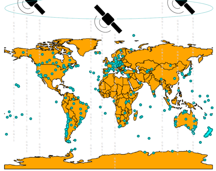
Beidou, Galileo, GLONASS, GPS, GROUND STATIONS, QZSS, IRNSS, SBAS |
Beidou P, Galileo P, GLONASS P, GPSP, GNSS RECEIVER, QZSS P, IRNSS P, SBAS P |
1992-01-01 to Present |
N: 90
S: -90
E: 180
W: -180
|
|
RINEX |
| Ground-Based Global Navigation Satellite System (GNSS) Observation Summary Data (30-second sampling, daily files), output of TEQC (translation, editing, and quality check) from NASA CDDIS |
1 |
Beidou, Galileo, GLONASS, GPS, GROUND STATIONS, QZSS, IRNSS, SBAS |
Beidou P, Galileo P, GLONASS P, GPSP, GNSS RECEIVERS, QZSS P, IRNSS P, SBAS P |
1992-01-01 to Present |
N: 90
S: -90
E: 180
W: -180
|
|
RINEX |
| Ground-Based Global Navigation Satellite System (GNSS) Quasi-Zenith Satellite System (QZSS) Broadcast Ephemeris Data (30-second sampling, hourly files) from NASA CDDIS |
1 |
QZSS, GROUND STATIONS |
QZSS P, GNSS |
1992-01-01 to Present |
N: 90
S: -90
E: 180
W: -180
|
|
RINEX |
| Ground-Based Global Navigation Satellite System (GNSS) Quasi-Zenith Satellite System (QZSS) Broadcast Ephemeris Data (daily files) from NASA CDDIS |
1 |
QZSS, GROUND STATIONS |
QZSS P, GNSS RECEIVERS |
1992-01-01 to Present |
N: 90
S: -90
E: 180
W: -180
|
|
RINEX |
| Ground-Based Global Navigation Satellite System (GNSS) Quasi-Zenith Satellite System (QZSS) Broadcast Ephemeris Data (sub-hourly files) from NASA CDDIS |
1 |
QZSS, GROUND STATIONS |
QZSS P, GNSS |
1992-01-01 to Present |
N: 90
S: -90
E: 180
W: -180
|
|
RINEX |
| Ground-Based Global Navigation Satellite System (GNSS) Satellite-Based Augmentation System (SBAS) Broadcast Ephemeris Data (30-second sampling, hourly files) from NASA CDDIS |
1 |
SBAS, GROUND STATIONS |
SBAS P, GNSS |
1992-01-01 to Present |
N: 90
S: -90
E: 180
W: -180
|
|
RINEX |
| Ground-Based Global Navigation Satellite System (GNSS) Satellite-Based Augmentation System (SBAS) Broadcast Ephemeris Data (daily files) from NASA CDDIS |
1 |
SBAS, GROUND STATIONS |
SBAS P, GNSS RECEIVERS |
1992-01-01 to Present |
N: 90
S: -90
E: 180
W: -180
|
|
RINEX |
| Ground-Based Global Navigation Satellite System (GNSS) Satellite-Based Augmentation System (SBAS) Broadcast Ephemeris Data (sub-hourly files) from NASA CDDIS |
1 |
SBAS, GROUND STATIONS |
SBAS P, GNSS |
1992-01-01 to Present |
N: 90
S: -90
E: 180
W: -180
|
|
RINEX |
| Ground-Based Global Navigation Satellite System (GNSS)-based Upper Atmospheric Realtime Disaster Information and Alert Network (GUARDIAN) Galileo daily antenna phase centers (24-hour files) from NASA CDDIS |
1 |
Galileo, GROUND STATIONS |
|
2023-10-01 |
N: 90
S: -90
E: 180
W: -180
|
|
JPL Piecewise Constant Model Parameter (ASCII) |
| Ground-Based Global Navigation Satellite System (GNSS)-based Upper Atmospheric Realtime Disaster Information and Alert Network (GUARDIAN) Galileo daily antenna phase maps (meta data, 24-hour files) from NASA CDDIS |
1 |
Galileo, GROUND STATIONS |
|
2023-10-01 |
N: 90
S: -90
E: 180
W: -180
|
|
JPL MetaFile (ASCII) |
| Ground-Based Global Navigation Satellite System (GNSS)-based Upper Atmospheric Realtime Disaster Information and Alert Network (GUARDIAN) Galileo Earth Orientation Parameters (1-day sampling, 7-day files) from NASA CDDIS |
1 |
Galileo, GROUND STATIONS |
|
2023-10-01 |
N: 90
S: -90
E: 180
W: -180
|
|
JPL GEOP (ASCII) |
| Ground-Based Global Navigation Satellite System (GNSS)-based Upper Atmospheric Realtime Disaster Information and Alert Network (GUARDIAN) GLONASS daily antenna phase centers (24-hour files) from NASA CDDIS |
1 |
GLONASS, GROUND STATIONS |
|
2023-10-01 |
N: 90
S: -90
E: 180
W: -180
|
|
JPL Piecewise Constant Model Parameter (ASCII) |
| Ground-Based Global Navigation Satellite System (GNSS)-based Upper Atmospheric Realtime Disaster Information and Alert Network (GUARDIAN) GLONASS daily antenna phase maps (meta data, 24-hour files) from NASA CDDIS |
1 |
GLONASS, GROUND STATIONS |
|
2023-10-01 |
N: 90
S: -90
E: 180
W: -180
|
|
JPL MetaFile (ASCII) |
| Ground-Based Global Navigation Satellite System (GNSS)-based Upper Atmospheric Realtime Disaster Information and Alert Network (GUARDIAN) GLONASS Earth Orientation Parameters (1-day sampling, 7-day files) from NASA CDDIS |
1 |
GLONASS, GROUND STATIONS |
GNSS RECEIVER |
2023-10-01 |
N: 90
S: -90
E: 180
W: -180
|
|
JPL GEOP (ASCII) |
| Ground-Based Global Navigation Satellite System (GNSS)-based Upper Atmospheric Realtime Disaster Information and Alert Network (GUARDIAN) GPS daily antenna phase centers (24-hour files) from NASA CDDIS |
1 |
GPS, GROUND STATIONS |
|
2023-10-01 |
N: 90
S: -90
E: 180
W: -180
|
|
JPL Piecewise Constant Model Parameter (ASCII) |
| Ground-Based Global Navigation Satellite System (GNSS)-based Upper Atmospheric Realtime Disaster Information and Alert Network (GUARDIAN) GPS daily antenna phase maps (meta data, 24-hour files) from NASA CDDIS |
1 |
GPS, GROUND STATIONS |
|
2023-10-01 |
N: 90
S: -90
E: 180
W: -180
|
|
JPL MetaFile (ASCII) |
| Ground-Based Global Navigation Satellite System (GNSS)-based Upper Atmospheric Realtime Disaster Information and Alert Network (GUARDIAN) GPS Earth Orientation Parameters (1-day sampling, 7-day files) from NASA CDDIS |
1 |
GPS, GROUND STATIONS |
|
2023-10-01 |
N: 90
S: -90
E: 180
W: -180
|
|
JPL GEOP (ASCII) |
| Ground-Based Global Navigation Satellite System (GNSS)-based Upper Atmospheric Realtime Disaster Information and Alert Network (GUARDIAN) Near Real-Time Ionospheric Total Electron Count (5-second sampling, 24-hour files) from NASA CDDIS |
1 |
Galileo, GROUND STATIONS |
GNSS RECEIVER |
2022-09-01 |
N: 90
S: -90
E: 180
W: -180
|
|
CSV |
| Ground-Based Global Navigation Satellite System High-rate Mixed Broadcast Ephemeris Data (sub-hourly files) from NASA CDDIS |
1 |
Beidou, Galileo, GLONASS, GPS, GROUND STATIONS, QZSS, IRNSS, SBAS |
Beidou P, Galileo P, GLONASS P, GPSP, GNSS RECEIVER, QZSS P, IRNSS P, SBAS P |
1992-01-01 to Present |
N: 90
S: -90
E: 180
W: -180
|
|
RINEX |
| Ground-Based Global Navigation Satellite System Mixed Broadcast Ephemeris Data (daily files) from NASA CDDIS |
1 |
Beidou, Galileo, GLONASS, GPS, GROUND STATIONS, QZSS, IRNSS, SBAS |
Beidou P, Galileo P, GLONASS P, GPSP, GNSS RECEIVER, QZSS P, IRNSS P, SBAS P |
1992-01-01 to Present |
N: 90
S: -90
E: 180
W: -180
|
|
RINEX |
| Ground-Based GNSS-based Upper Atmospheric Realtime Disaster Information and Alert Network (GUARDIAN) Galileo daily accumulated real-time Precise Orbit Determination (POD) Attitude Quaternions (30-second sampling, 24-hour files) from NASA CDDIS |
1 |
GLONASS, GROUND STATIONS |
|
2023-10-01 |
N: 90
S: -90
E: 180
W: -180
|
|
JPL Quaternions (ASCII) |
| Ground-Based GNSS-based Upper Atmospheric Realtime Disaster Information and Alert Network (GUARDIAN) Galileo daily accumulated real-time Precise Orbit Determination (POD) Clock Corrections (60-second sampling, 24-hour files) from NASA CDDIS |
1 |
Galileo, GROUND STATIONS |
GNSS RECEIVER |
2023-10-01 |
N: 90
S: -90
E: 180
W: -180
|
|
JPL Time Dependent Parameter (ASCII) |
| Ground-Based GNSS-based Upper Atmospheric Realtime Disaster Information and Alert Network (GUARDIAN) Galileo daily accumulated real-time Precise Orbit Determination (POD) orbits (60-second sampling, 24-hour files) from NASA CDDIS |
1 |
GLONASS, GROUND STATIONS |
|
2023-10-01 |
N: 90
S: -90
E: 180
W: -180
|
|
JPL pos-GOA (ASCII) |
| Ground-Based GNSS-based Upper Atmospheric Realtime Disaster Information and Alert Network (GUARDIAN) Galileo daily accumulated real-time Precise Orbit Determination (POD) Clock Corrections (1-second sampling, 24-hour files) from NASA CDDIS |
1 |
Galileo, GROUND STATIONS |
GNSS RECEIVER |
2023-10-01 |
N: 90
S: -90
E: 180
W: -180
|
|
JPL Time Dependent Parameter (ASCII) |
| Ground-Based GNSS-based Upper Atmospheric Realtime Disaster Information and Alert Network (GUARDIAN) GLONASS daily accumulated real-time Precise Orbit Determination (POD) Attitude Quaternions (30-second sampling, 24-hour files) from NASA CDDIS |
1 |
GLONASS, GROUND STATIONS |
|
2023-10-01 |
N: 90
S: -90
E: 180
W: -180
|
|
JPL Quaternions (ASCII) |