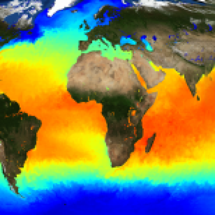
| GHRSST Level 2P NAVO 1 m Depth Global Sea Surface Temperature version 3.0 from the Visible Infrared Imaging Radiometer Suite (VIIRS) on the NOAA-20 satellite |
3.0 |
NOAA-20 |
VIIRS |
2024-02-20 |
N: 90
S: -90
E: 180
W: -180
|
750 Meters x 750 Meters |
netCDF-4 |
| GHRSST Level 2P NAVO 1 m Depth Global Sea Surface Temperature version 3.0 from the Visible Infrared Imaging Radiometer Suite (VIIRS) on the NOAA-21 satellite |
3.0 |
NOAA-21 |
VIIRS |
2024-02-21 |
N: 90
S: -90
E: 180
W: -180
|
750 Meters x 750 Meters |
netCDF-4 |
| GHRSST Level 2P NOAA ACSPO SST v2.80 from VIIRS on NOAA-21 Satellite |
2.80 |
NOAA-21 |
VIIRS |
2023-03-19 |
N: 90
S: -90
E: 180
W: -180
|
750 Meters x 750 Meters |
netCDF-4 |
| GHRSST Level 2P NOAA STAR SST v2.80 from VIIRS on NOAA-20 Satellite |
2.80 |
NOAA-20 |
VIIRS |
2018-01-05 |
N: 90
S: -90
E: 180
W: -180
|
750 Meters x 750 Meters |
netCDF-4 |
| GHRSST Level 2P NOAA STAR SST v2.80 from VIIRS on S-NPP Satellite |
2.80 |
Suomi-NPP |
VIIRS |
2012-02-01 |
N: 90
S: -90
E: 180
W: -180
|
750 Meters x 750 Meters |
netCDF-4 |
| GHRSST Level 2P Regional 1m Sea Surface Temperature from the Advanced Very High Resolution Radiometer (AVHRR) on the NOAA-19 satellite produced by NAVO |
1 |
NOAA-19 |
AVHRR |
2013-05-05 to 2021-01-16 |
N: 80
S: -70
E: 180
W: -180
|
2200 Meters x 2200 Meters |
netCDF-4 |
| GHRSST Level 2P Sea Surface Temperature version 1.0 from the Electro-Optical Infrared Weather System Geostationary (EWSG1) produced by NAVO |
1.0 |
GOES-13 |
ABI |
2021-12-06 to 2023-11-08 |
N: 78
S: -78
E: 140
W: -16
|
4000 Meters x 4000 Meters |
netCDF-4 |
| GHRSST Level 2P Sea Surface Temperature version 1.0 from the Electro-Optical Infrared Weather System Geostationary (EWSG2) produced by NAVO |
1.0 |
GOES-15 |
GOES-15 Imager |
2023-12-03 to Present |
N: 65
S: -65
E: 140
W: -20
|
4000 Meters x 4000 Meters |
netCDF-4 |
| GHRSST Level 2P sub-skin Sea Surface Temperature from the Advanced Very High Resolution Radiometer (AVHRR) on Metop satellites (currently Metop-A) (GDS V2) produced by OSI SAF |
1 |
METOP-A |
AVHRR-3 |
2013-06-04 to 2016-11-23 |
N: 90
S: -90
E: 180
W: -180
|
1100 Meters x 1100 Meters |
netCDF-4 |
| GHRSST Level 2P sub-skin Sea Surface Temperature from the Advanced Very High Resolution Radiometer (AVHRR) on Metop satellites (currently Metop-B) (GDS V2) produced by OSI SAF |
1 |
METOP-B |
AVHRR |
2016-01-19 |
N: 90
S: -90
E: 180
W: -180
|
1100 Meters x 1100 Meters |
netCDF-4 |
| GHRSST Level 2P Western Atlantic Regional Skin Sea Surface Temperature from the Geostationary Operational Environmental Satellites (GOES) Imager on the GOES-13 satellite (GDS version 2) |
1.0 |
GOES-15 |
GOES-15 Imager |
2013-08-01 to 2018-01-08 |
N: 68
S: -68
E: -0
W: -155
|
4200 Meters x 4600 Meters |
netCDF-4 |
| GHRSST Level 2P Western Pacific Regional Skin Sea Surface Temperature from the Multifunctional Transport Satellite 2 (MTSAT-2) (GDS version 2) |
1.0 |
MTSAT-2 |
MTSAT 2 Imager |
2013-08-01 to 2015-12-04 |
N: 79
S: -80
E: 180
W: 64
,
N: 79
S: -80
E: -134
W: -180
|
4000 Meters x 4000 Meters |
netCDF-4 |
| GHRSST Level 3C Atlantic sub-skin Sea Surface Temperature from the Spinning Enhanced Visible and Infrared Imager (SEVIRI) on MSG at 0 degree longitude (GDS V2) produced by OSI SAF |
1 |
MSG |
SEVIRI |
2004-06-01 |
N: 60
S: -60
E: 60
W: -60
|
0.05 Decimal Degrees x 0.05 Decimal Degrees |
netCDF-4 |
| GHRSST Level 3C Indian-Ocean (IO) sub-skin Sea Surface Temperature from the Spinning Enhanced Visible and Infrared Imager (SEVIRI) on MSG in GDS2 format produced by OSISAF |
1.0 |
MSG |
SEVIRI |
2017-03-28 |
N: 60
S: -60
E: 101.5
W: -18.5
|
0.05 Decimal Degrees x 0.05 Decimal Degrees |
netCDF-4 |
| GHRSST Level 3C North Atlantic Regional (NAR) subskin Sea Surface Temperature from Metop/AVHRR (GDS V2) produced by OSI SAF |
1 |
METOP-B |
AVHRR-3 |
2016-01-06 |
N: 78.24
S: 13.59
E: 72.97
W: -76.02
|
0.02 Decimal Degrees x 0.02 Decimal Degrees |
netCDF-4 |
| GHRSST Level 3C North Atlantic Regional (NAR) subskin Sea Surface Temperature from SNPP/VIIRS and Metop-A/AVHRR (GDS V2) produced by OSI SAF |
1 |
METOP-A |
AVHRR-3 |
2013-06-04 to 2016-11-22 |
N: 78.24
S: 23.59
E: 72.97
W: -76.02
|
0.02 Decimal Degrees x 0.02 Decimal Degrees |
netCDF-4 |
| GHRSST Level 3C North Atlantic Regional (NAR) subskin Sea Surface Temperature from SNPP/VIIRS (GDS V2) produced by OSI SAF |
1 |
Suomi-NPP |
VIIRS |
2013-11-11 to 2020-11-20 |
N: 78.24
S: 13.59
E: 72.97
W: -76.02
|
0.02 Decimal Degrees x 0.02 Decimal Degrees |
netCDF-4 |
| GHRSST Level 3C North Atlantic Regional Subskin Sea Surface Temperature from the Advanced Very High Resolution Radiometer (AVHRR) on NOAA-19 (GDS2 version) |
1 |
NOAA-20 |
AVHRR-3 |
2013-06-04 to 2013-11-20 |
N: 78.24
S: 23.59
E: 72.97
W: -76.02
|
0.02 Decimal Degrees x 0.02 Decimal Degrees |
netCDF-4 |
| GHRSST Level 3C sub-skin Sea Surface Temperature from the Geostationary Operational Environmental Satellites (GOES 13) Imager in East position (GDS V2) produced by OSI SAF |
1 |
GOES-13 |
GOES-13 Imager |
2010-01-01 to 2017-12-14 |
N: 60
S: -60
E: -15
W: -135
|
0.05 Decimal Degrees x 0.05 Decimal Degrees |
netCDF-4 |
| GHRSST Level 3U Global Global Near-Real Subskin Sea Surface Temperature version 8.2 (v8.2) from the Advanced Microwave Scanning Radiometer 2 (AMSR2) on the GCOM-W satellite by REMSS |
8.2 |
GCOM-W1 |
AMSR2 |
2012-07-02 |
N: 90
S: -90
E: 180
W: -179
|
0.25 Decimal Degrees x 0.25 Decimal Degrees |
netCDF-4 |
| GHRSST Level 3U Global Near-Real-Time Subskin Sea Surface Temperature version 8a from the Advanced Microwave Scanning Radiometer 2 on the GCOM-W satellite |
8a |
GCOM-W1 |
AMSR2 |
2012-07-02 |
N: 90
S: -90
E: 180
W: -179
|
0.25 Decimal Degrees x 0.25 Decimal Degrees |
netCDF-4 |
| GHRSST Level 3U Global Subskin Sea Surface Temperature from GMI onboard GPM satellite |
8.2a |
GPM |
GMI |
2014-03-04 |
N: 90
S: -90
E: 180
W: -180
|
0.25 Decimal Degrees x 0.25 Decimal Degrees |
netCDF-4 |
| GHRSST Level 3U Global Subskin Sea Surface Temperature from the Advanced Scanning Microwave Radiometer - Earth Observing System (AMSR-E) on the NASA Aqua Satellite |
7a |
Aqua |
AMSR-E |
2002-06-01 to 2011-10-04 |
N: 90
S: -90
E: 180
W: -180
|
0.25 Decimal Degrees x 0.25 Decimal Degrees |
netCDF-4 |
| GHRSST Level 3U Global Subskin Sea Surface Temperature from TMI onboard TRMM satellite |
7.1a |
TRMM |
TMI |
1997-12-08 to 2015-01-01 |
N: 90
S: -90
E: 180
W: -180
|
0.25 Decimal Degrees x 0.25 Decimal Degrees |
netCDF-4 |
| GHRSST Level 3U Global Subskin Sea Surface Temperature version 8.2 from the Advanced Microwave Scanning Radiometer 2 on the GCOM-W satellite by REMSS |
8.2 |
GCOM-W1 |
AMSR2 |
2012-07-02 |
N: 90
S: -90
E: 180
W: -179
|
0.25 Decimal Degrees x 0.25 Decimal Degrees |
netCDF-4 |