We are in the process of migrating all NASA Earth science data sites into Earthdata from now until end of 2026. Not all NASA Earth science data and resources will appear here until then. Thank you for your patience as we make this transition.
Read about the Web Unification Project
Coastal Processes News
Articles, resources, and announcements from Coastal Processes.
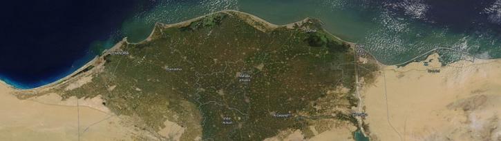
Image captured on 01 April 2018, by the MODIS instrument, aboard the Terra satellite.
Worldview Image of the Week
Sept. 11, 2020

Image captured on 6 March 2016 by the MODIS instrument, aboard the Terra satellite.
Worldview Image of the Week
Sept. 11, 2020
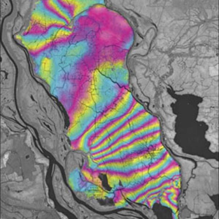
A technique to study land senses water-level changes in the Mississippi River delta.
Feature Article
July 28, 2020

DINAS-COAST scientists create software to better understand coastal vulnerability to sea level rise under a variety of climate and socioeconomic scenarios.
Feature Article
July 22, 2020

A dataset with digital elevation models (DEMs) of the Greenland Ice Sheet is the latest release from NASA’s Oceans Melting Greenland (OMG) mission.
News
July 9, 2020
SHOWING 5 OF 37