We are in the process of migrating all NASA Earth science data sites into Earthdata from now until end of 2026. Not all NASA Earth science data and resources will appear here until then. Thank you for your patience as we make this transition.
Read about the Web Unification Project
Coastal Processes News
Articles, resources, and announcements from Coastal Processes.

Who uses NASA Earth science data? Ben Holt, to study polar sea ice, coastal oceanography, and marine pollution
Data User Story
Dec. 21, 2020

The 16 datasets in the West Africa Coastal Vulnerability Mapping collection provide a wealth of information about the stresses affecting this important region.
Feature Article
Nov. 4, 2020

Data from the Oceans Melting Greenland (OMG) mission provide a revolutionary look at ocean/ice interactions and estimates of global sea level rise.
News
Nov. 4, 2020
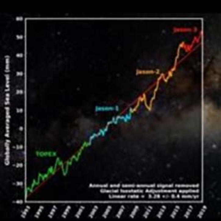
Using data from four ocean altimetry missions, a new PO.DAAC animation shows more than a quarter-century of global average sea level change.
News
Nov. 4, 2020

Features up-to-date NASA sea level change research, science and news
News
Nov. 4, 2020
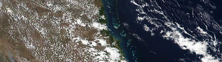
Image captured on 14 November 2016 by the VIIRS instrument, aboard the joint NASA/NOAA Suomi-NPP satellite.
Worldview Image of the Week
Sept. 11, 2020
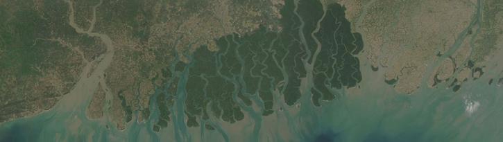
Image captured on 24 February 2018, by the MODIS instrument, aboard the Aqua satellite.
Worldview Image of the Week
Sept. 11, 2020

Image captured on 17 January 2016 by the MODIS instrument, aboard the Terra satellite.
Worldview Image of the Week
Sept. 11, 2020
SHOWING 8 OF 37