We are in the process of migrating all NASA Earth science data sites into Earthdata from now until end of 2026. Not all NASA Earth science data and resources will appear here until then. Thank you for your patience as we make this transition.
Read about the Web Unification Project
Water Management News
Articles, resources, and announcements from Water Management.

This training offered by NASA's Applied Remote Sensing Training (ARSET) program covers applicable data sources for assessing groundwater change.
News
March 9, 2026

Researchers used data from the GRACE/GRACE-FO platform to estimate that the region has lost a combined 34 cubic kilometers of groundwater since 2002.
Feature Article
Dec. 5, 2025

Researchers used the Emergency Environmental Health Dashboard, which leverages NASA's record of satellite imagery, to assess post-storm impacts to water systems and private wells.
News
Nov. 18, 2025

Harmonized Landsat Sentinel-2 (HLS) image captured on August 30, 2025, by the OLI instrument aboard the Landsat 8 platform.
Worldview Image of the Week
Sept. 4, 2025
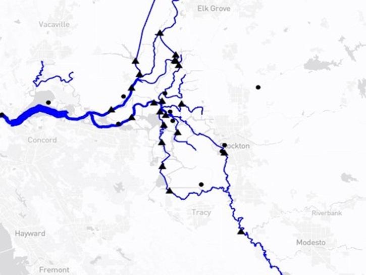
The Water Information from SPace (WISP) dashboard brings together data from NASA’s SWOT satellite and USGS streamgages in a user-friendly application.
Blog
July 30, 2025
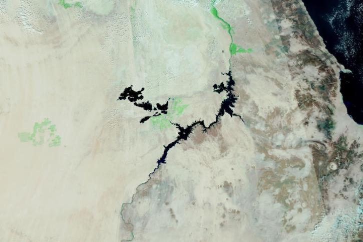
Image captured on Dec 28, 2023, by the VIIRS instrument aboard the joint NASA/NOAA Suomi NPP satellite.
Worldview Image of the Week
Dec. 28, 2023

Image captured on Nov 4, 2022, by the MSI instrument aboard the ESA (European Space Agency) Sentinel-2A and -2B satellites.
Worldview Image of the Week
Nov. 8, 2022
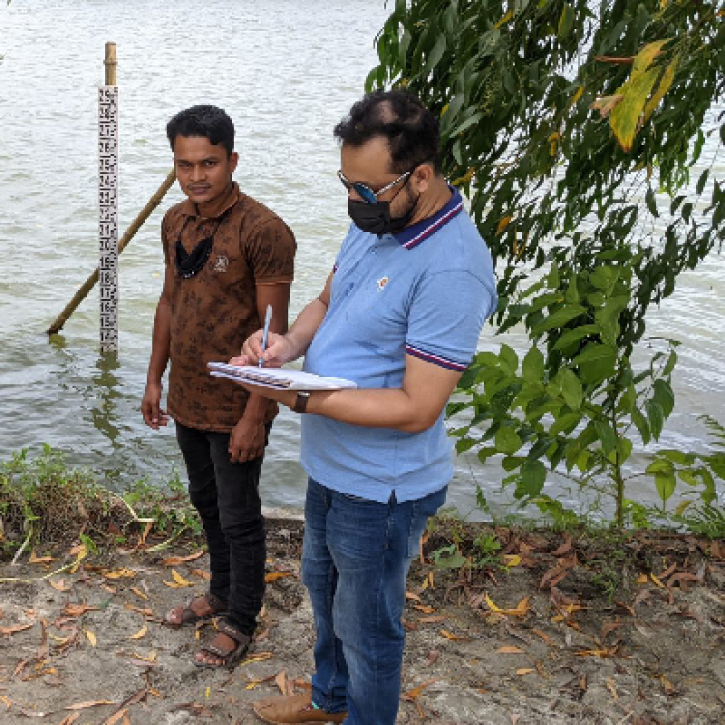
NASA satellite data and citizen scientists are giving the Bangladesh government a better understanding of the country's surface water storage.
Feature Article
Oct. 19, 2022
SHOWING 8 OF 28