We are in the process of migrating all NASA Earth science data sites into Earthdata from now until end of 2026. Not all NASA Earth science data and resources will appear here until then. Thank you for your patience as we make this transition.
Read about the Web Unification Project
Natural Hazards Learning Resources
Webinars, tutorials, data recipes and more to help you work with Natural Hazards.
Filters

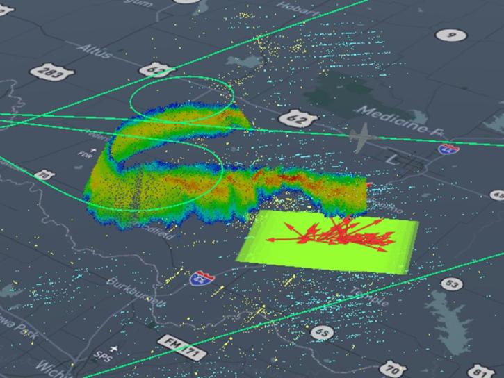
The CALIPSO satellite and the Earth Polychromatic Imaging Camera (EPIC) on NOAA’s DSCOVR satellite collected valuable data on one of the worst fires and fire seasons in California history.
Data in Action
Nov. 16, 2020

This ARSET training covers the use of remote sensing in determining and explaining urban heat islands, and ways to mitigate the effects.
Training
Nov. 10-24, 2020

Join us for an introduction to NASA SEDAC's Global COVID-19 Viewer - a map-based tool for understanding the spread of the Coronavirus and underlying risk factors. During the webinar, participants will learn about its development and then a live demonstration of the viewer focusing on current hotspots, interesting trends, and an exploration of the risk factors will be provided.
Webinar
Oct. 30, 2020

Users can access information about tropical storms through a representational state transfer (REST) interface provided by NASA’s Global Hydrometeorology Resource Center Distributed Active Archive Center (GHRC DAAC).
Tutorial
Oct. 3, 2020

Get to know NASA's Land Processes Distributed Active Archive Center (LP DAAC) in this Tech Talk Webinar.
Webinar
Oct. 1, 2020

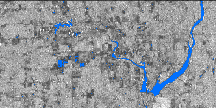
Explore sea surface temperature anomalies in the Gulf of America before, during, and after Tropical Cyclones Laura and Marco with NASA's MUR SST dataset.
Data in Action
Sept. 10, 2020
This presentation will discuss NASA's Global Hydrology Resource Center Distributed Active Archive Center (GHRC DAAC) activities to transition the user experience to the cloud, how these efforts are being applied (e.g., tools, visualizations, and analysis), and how this supports users.
Webinar
July 28, 2020
In this webinar, we will demonstrate approaches for using SAR datasets in GIS environments to detect landscape change and map flooding events with a focus on Sentinel-1 datasets.
Webinar
July 10, 2020
SHOWING 8 OF 154
Frequently Asked Questions
Earthdata Forum
Our online forum provides a space for users to browse thousands of FAQs about research needs, data, and data applications. You can also submit new questions for our experts to answer.
Submit Questions to Earthdata Forumand View Expert Responses