We are in the process of migrating all NASA Earth science data sites into Earthdata from now until end of 2026. Not all NASA Earth science data and resources will appear here until then. Thank you for your patience as we make this transition.
Read about the Web Unification Project
Error message
The submitted value 10 in the Items element is not allowed.Snow Cover Data Access and Tools
From discovery to visualization, data tools such as Application for Extracting and Exploring Analysis Ready Samples (AppEEARS), Snow Today, and Worldview guide users in making the most of snow cover data.
Snow Cover Datasets
| Dataset | Platforms | Instruments | Temporal Extent | Location Keywords | Data Format |
|---|---|---|---|---|---|
| MODIS/Terra Snow Cover Monthly L3 Global 0.05Deg CMG V061 | Terra | MODIS | 2000-03-01 to Present | GLOBAL LAND | HDF-EOS2 |
| NCA-LDAS Noah-3.3 Land Surface Model L4 Daily 0.125 x 0.125 degree V2.0 (NCALDAS_NOAH0125_D) at GES DISC | Noah-LSM | NOT APPLICABLE | 1979-01-02 to 2016-12-31 | NORTH AMERICA | |
| Near-Real-Time AMSR2 EASE-Grid Daily Global Ice Concentration and Snow Extent V001 | GCOM-W1 | AMSR2 | 2024-01-01 to Present | NORTHERN HEMISPHERE, ARCTIC, ANTARCTICA, SOUTHERN HEMISPHERE | HDF-EOS4, HDF-EOS2 |
| Near-Real-Time SSM/I EASE-Grid Daily Global Ice Concentration and Snow Extent V002 | DMSP 5D-2/F13 | SSM/I | 1995-05-04 to 2009-09-11 | ANTARCTICA, ARCTIC, NORTHERN HEMISPHERE, SOUTHERN HEMISPHERE | HDF-EOS2 |
| Near-Real-Time SSM/I-SSMIS EASE-Grid Daily Global Ice Concentration and Snow Extent V003 | DMSP 5D-3/F16 | SSMIS | 2012-01-01 to Present | ANTARCTICA, ARCTIC, NORTHERN HEMISPHERE, SOUTHERN HEMISPHERE | HDF-EOS2 |
| Near-Real-Time SSM/I-SSMIS EASE-Grid Daily Global Ice Concentration and Snow Extent V004 | DMSP 5D-3/F17 | SSMIS | 2009-08-17 to Present | ARCTIC, ANTARCTICA, NORTHERN HEMISPHERE, SOUTHERN HEMISPHERE | HDF-EOS2 |
| Near-Real-Time SSM/I-SSMIS EASE-Grid Daily Global Ice Concentration and Snow Extent V005 | DMSP 5D-3/F18 | SSMIS | 2016-12-01 to Present | SOUTHERN HEMISPHERE, NORTHERN HEMISPHERE, ARCTIC, ANTARCTICA | HDF-EOS2 |
| Northern Hemisphere Snow Cover Monthly Statistics at 1 Degree Resolution V001 (NHSNOWM) at GES DISC | GOES | AVHRR | 2000-01-01 to 2014-11-30 | NORTHERN HEMISPHERE | |
| Primary Ancillary Data Geo-Colocated to OMI/Aura UV2 1-Orbit L2 Swath 13x24km V4 (OMUANC) at GES DISC | Aura, GEOS-5 | OMI, NOT APPLICABLE | 2004-10-01 to Present | BOUNDARY LAYER, STRATOSPHERE, TROPOSPHERE | |
| Primary Ancillary Data Geo-Colocated to OMI/Aura VIS 1-Orbit L2 Swath 13x24km V4 (OMVANC) at GES DISC | Aura, GEOS-5 | OMI, NOT APPLICABLE | 2004-10-01 to Present | BOUNDARY LAYER, STRATOSPHERE, TROPOSPHERE |
SHOWING 10 OF 105
Featured Observation Method: VIIRS
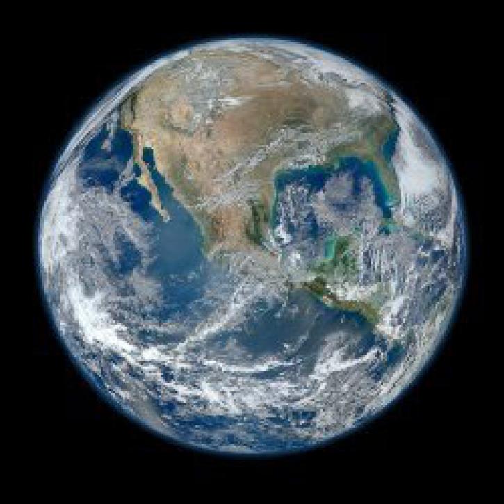
The Visible Infrared Imaging Radiometer Suite (VIIRS) is an instrument aboard the joint NASA/NOAA Suomi National Polar-orbiting Partnership (Suomi NPP) and NOAA-platforms. VIIRS collects visible and infrared imagery along with global observations of Earth including cryosphere.
The algorithms VIIRS uses for snow cover and sea ice products are specifically designed to be compatible with similar products from older the Moderate Resolution Imaging Spectroradiometer (MODIS) instrument, which supports comparison between datasets to facilitate long-term climate data records.
The algorithms VIIRS uses for snow cover and sea ice products are specifically designed to be compatible with similar products from older the Moderate Resolution Imaging Spectroradiometer (MODIS) instrument, which supports comparison between datasets to facilitate long-term climate data records.

Join us to learn how to discover, subset, access and visualize both MODIS and VIIRS data products using a suite of user-friendly tools developed by NASA's ORNL DAAC.

The Visible Infrared Imaging Radiometer Suite (VIIRS) will help ensure continuity of Earth observations after the upcoming retirement of the Moderate Resolution Imaging Spectroradiometer (MODIS).
VIIRS I-band (375 m) Active Fire and Corrected Reflectance products are the newest near real-time products available through LANCE.
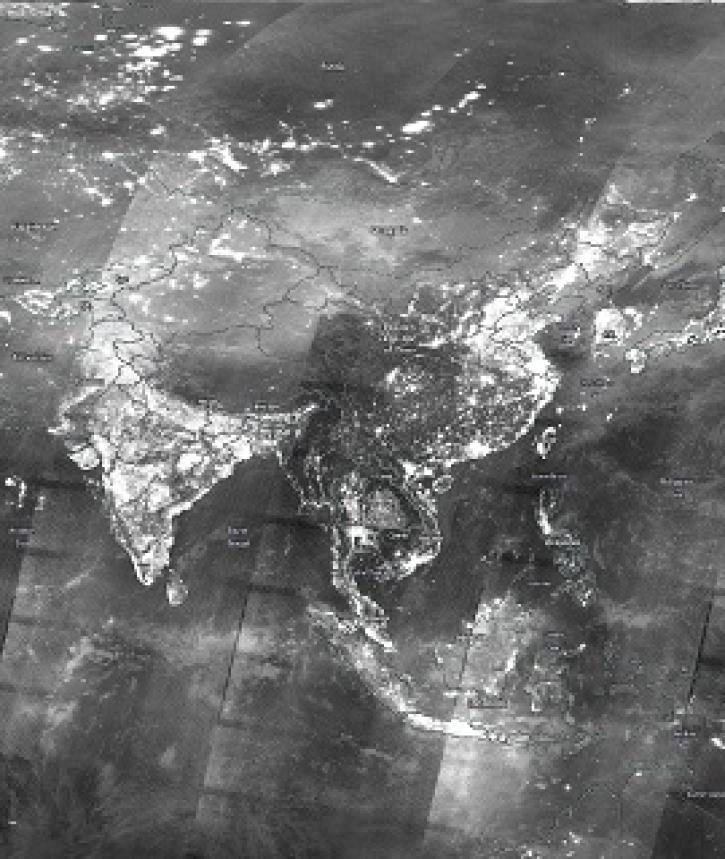
Image captured on 29 December 2019, by the VIIRS instrument, aboard the joint NASA/NOAA Suomi NPP satellite.
Snow Cover Data Tools
| Tool Sort descending | Description | Services | |
|---|---|---|---|
| AppEEARS | The The Application for Extracting and Exploring Analysis Ready Samples (AppEEARS) offers users a simple and efficient way to perform data access and transformation processes. | Search and Discovery, Subsetting, Customization, Downloading, Visualization | |
| Worldview | Worldview offers the capability to interactively browse over 1,200 global, full-resolution satellite imagery layers and download the underlying data. | Analysis, Search and Discovery, Visualization, Access, Comparison, Monitoring Natural Events |
SHOWING 2 OF 2
Frequently Asked Questions
Earthdata Forum
Our online forum provides a space for users to browse thousands of FAQs about research needs, data, and data applications. You can also submit new questions for our experts to answer.
Submit Questions to Earthdata Forumand View Expert Responses