We are in the process of migrating all NASA Earth science data sites into Earthdata from now until end of 2026. Not all NASA Earth science data and resources will appear here until then. Thank you for your patience as we make this transition.
Read about the Web Unification Project
Climate Indicators Learning Resources
Webinars, tutorials, data recipes and more to help you work with Climate Indicators.
Filters

Research shows that coastal sea surface temperatures could be used as a proxy for detecting changes that are expected in the cycling of water between the oceans and continents.
Data in Action
April 18, 2024

Learn more about NASA's Application for Extracting and Exploring Analysis Ready Samples (AppEEARS). This webinar showcases the system's capabilities and highlights learning resources to help simplify data access workflows using AppEEARS.
Webinar
April 9, 2024

This ARSET training describes data format and quality considerations, tools, and techniques to process imagery at large scale from publicly available sources.
Training
March 5-19, 2024

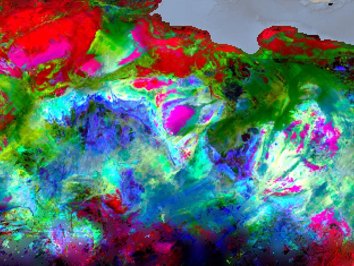
SWOT data reveals the topography of the ocean surface at finer scales than ever before.
Data in Action
Dec. 7, 2023
Sea surface height data from the Sentinel-6 Michael Freilich mission reveal complex interactions between the ocean and the atmosphere that affect global weather and climate such as El Niño.
Data in Action
Oct. 31, 2023

This ARSET Training describes climate risk assessment approaches that originate with stakeholder expertise.
Training
Sept. 19-21, 2023

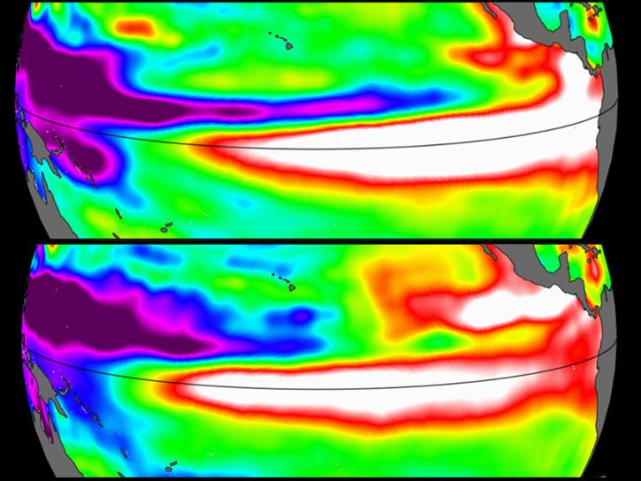
Satellite data provides indicators of El Niño events.
Data in Action
June 15, 2023
Join us June 28 at 2 p.m., EDT [UTC-4], to learn about NASA's Earth Surface Mineral Dust Source Investigation (EMIT) measurements and datasets along with how to discover, access, and work with EMIT data.
Webinar
June 8, 2023
SHOWING 8 OF 76
Frequently Asked Questions
Earthdata Forum
Our online forum provides a space for users to browse thousands of FAQs about research needs, data, and data applications. You can also submit new questions for our experts to answer.
Submit Questions to Earthdata Forumand View Expert Responses