We are in the process of migrating all NASA Earth science data sites into Earthdata from now until end of 2026. Not all NASA Earth science data and resources will appear here until then. Thank you for your patience as we make this transition.
Read about the Web Unification Project
Clouds News
Articles, resources, and announcements from Clouds.

Who uses NASA Earth science data? Dr. Brian Mapes, to study large-scale weather and climate processes.
Data User Story
Dec. 22, 2020

NASA’s global precipitation data and data processing systems have come a long way from the launch of TRMM in 1997 to the ongoing GPM mission.
Feature Article
Nov. 4, 2020
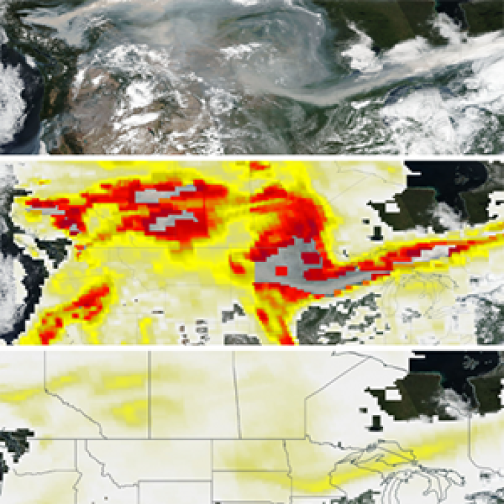
The new PyroCumuloNimbus product for the Ozone Mapping and Profiler Suite (OMPS) makes it easier to track and analyze high concentrations of aerosols from wildfires and similar events.
Feature Article
Nov. 4, 2020

Since 1999, NASA’s Terra Earth observing satellite has completed more than 100,000 orbits. The instrument data from this workhorse satellite has resulted in one of the longest continuous data records of our planet ever recorded from space.
Feature Article
Nov. 4, 2020
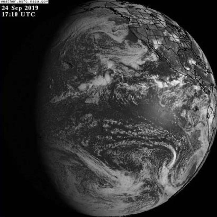
The addition of GOES-East, GOES-West, and Himawari-8 geostationary imagery updated every 10 minutes lets you view Earth as it is “right now.”
Feature Article
Nov. 4, 2020
Terra Fusion, a new data product and toolkit, allows researchers to combine data from all five Terra instruments into one cohesive dataset.
Feature Article
Nov. 4, 2020

MODIS Terra Collection 6 Aerosol, Cloud, and other Atmospheric Level-2 and Level-3 Data
News
Nov. 4, 2020

Image captured on 15 December 2019, by the MODIS instrument, aboard the Aqua satellite.
Worldview Image of the Week
Nov. 4, 2020
SHOWING 8 OF 69