We are in the process of migrating all NASA Earth science data sites into Earthdata from now until end of 2026. Not all NASA Earth science data and resources will appear here until then. Thank you for your patience as we make this transition.
Read about the Web Unification Project
Aerosols News
Articles, resources, and announcements from Aerosols.

Geographer Veerachai Tanpipat promotes the use of NASA's Fire Information for Resource Management System (FIRMS) throughout the Lower Mekong River Region.
Feature Article
Aug. 20, 2024

Base corrected reflectance image with aerosol optical thickness acquired on August 15, 2024, by the Suomi NPP/VIIRS instrument overlaid with AERONET sites showing ground-based aerosol optical depth measurements.
Worldview Image of the Week
Aug. 16, 2024

NASA Worldview added four layers from the Aerosol Robotic Network (AERONET) program to provide ground-based measurements of aerosol optical depth (AOD) and Angstrom parameter.
Blog
Aug. 16, 2024
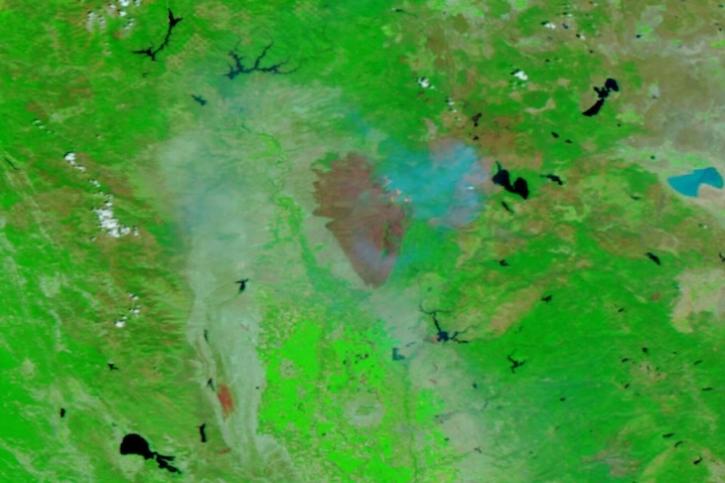
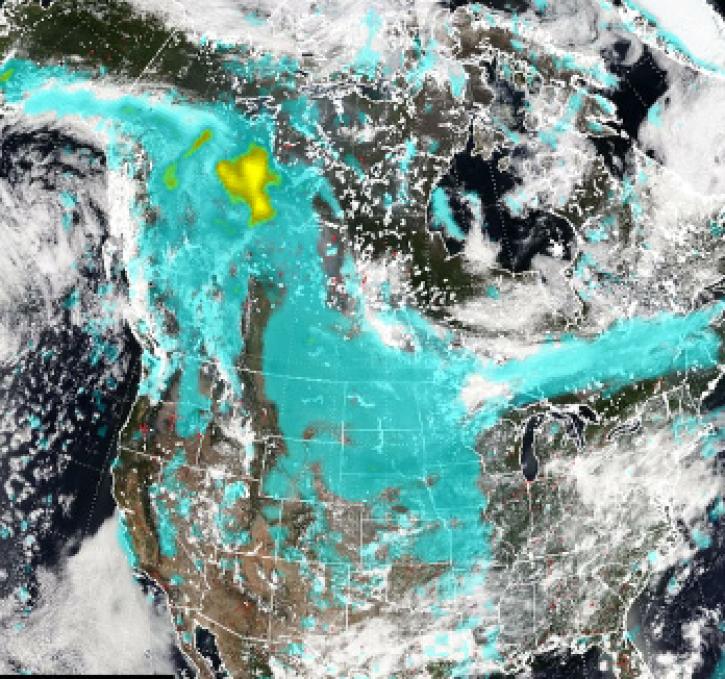
Image captured on July 31, 2024, by the VIIRS instrument aboard the joint NASA/NOAA NOAA-20 satellite.
Worldview Image of the Week
Aug. 1, 2024
Pyrocumulonimbus (pyroCb) events (fire thunderstorms) caused by wildfires in western Canada were detected by the Ozone Mapping and Profiler Suite (OMPS) instrument July 19-24, 2024.
News
July 30, 2024

Image captured on July 17, 2024, by the VIIRS instrument aboard the joint NASA/NOAA NOAA-20 satellite.
Worldview Image of the Week
July 18, 2024
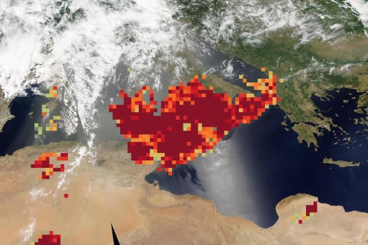
Image captured on June 20, 2024, by the MODIS and AIRS instruments aboard NASA's Aqua satellite.
Worldview Image of the Week
June 20, 2024
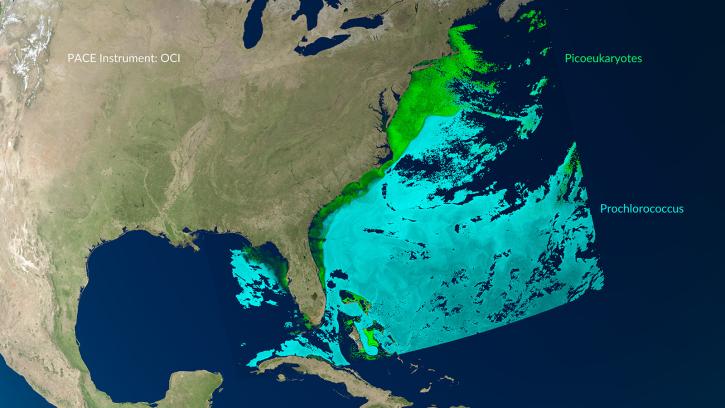
A series of Jupyter notebook tutorials show how to retrieve and use data from NASA's Plankton, Aerosol, Cloud, ocean Ecosystem (PACE) mission.
News
May 31, 2024
SHOWING 8 OF 250