Aerosols are tiny particles suspended in Earth's atmosphere. There are two main types of aerosols: primary aerosols,  such as sea spray, mineral dust, smoke, and ash, which become part of the atmosphere organically through natural processes. Secondary aerosols, such as sulfate aerosols from volcanoes or industrial emissions, undergo chemical changes when introduced into the atmosphere that result in new aerosol particles becoming part of the atmospheric makeup. All aerosols have the potential to affect public health as well as impact climate, weather, and ecology.

NASA instruments monitor many aspects of aerosols, including aerosol optical depth and thickness, aerosol index, and the movement and effect of dust, ash, and smoke. Data products including the Deep Blue (DB) Aerosol and Dark Target (DT) Aerosol products derived from the Visible Infrared Imaging Radiometer Suite (VIIRS) instruments and the Moderate Resolution Imaging Spectroradiometer (MODIS) Aerosol Product provide essential information about ambient aerosol optical thickness across the continents and the global ocean.

These data help characterize the chemical makeup of atmospheric aerosols and better understand where air pollution is most prevalent, helping local communities make science-informed decisions to support public health.

Get Aerosols Data

Access a range of datasets and data tools to further your research.

Learn How to Use Aerosols Data

Access a range of webinars, tutorials, data recipes, and data stories to enhance your knowledge of Earth Observation data.
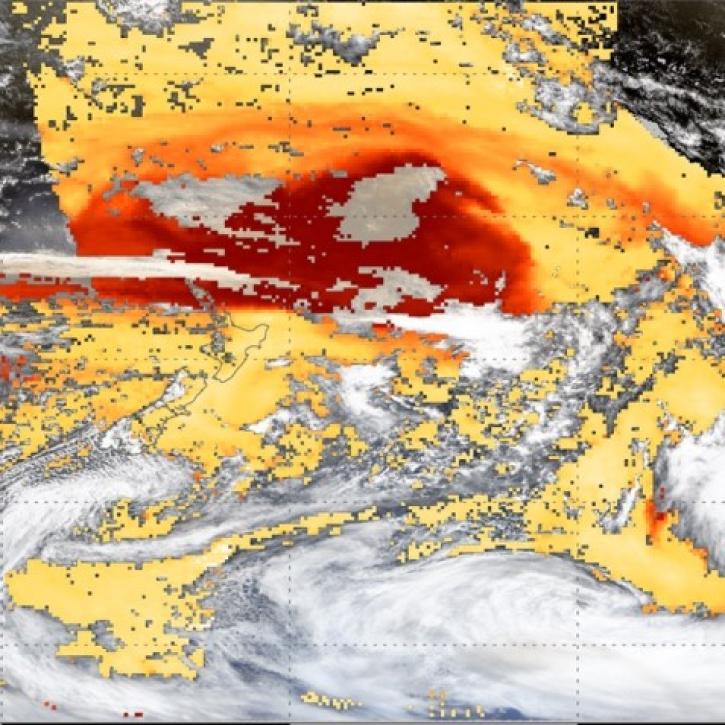
This image shows a smoke plume with high aerosol optical depth from the Australian Bushfires in January 2020. The GEO-LEO Dark Target Aerosol data product is used for this image.
Introduction to NASA's GEO-LEO Dark Target Aerosol Data Products
This webinar introduces the Geostationary Earth Orbit (GEO)-Low-Earth Orbit (LEO) Dark Target Aerosol data product suite and shows how to find, access, and download the data.
Graphic of Instruments Measuring Atmosphere with Lasers from Earth's Surface
NASA Atmospheric Composition Ground Networks Supporting Air Quality and Climate Applications
This ARSET training provides an overview of aerosol and trace gas measurements using active and passive techniques for ground based remote sensing.
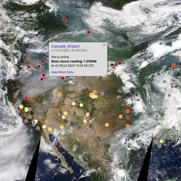
true-color satellite image of western U.S. with colored dots indicating AERONET sites; gray banner in center of image indicated selected site
Explore New Aerosol Layers in NASA Worldview
Worldview added four layers from the Aerosol Robotic Network (AERONET) program to provide ground-based measurements of aerosol optical depth (AOD) and Angstrom parameter.
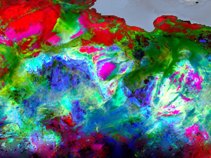
EMIT instrument data
Meet EMIT, the Newest Imaging Spectrometer on the International Space Station
Learn about NASA's Earth Surface Mineral Dust Source Investigation (EMIT), which records light reflected from Earth's surface to measure the surface composition of deserts and arid regions, and how to discover, access, and work with EMIT data.
Discover and Visualize Aerosols Data
NASA data help us understand Earth's changing systems in more detail than ever before, and visualizations bring these data to life, making Earth science concepts accessible, beautiful, and impactful.
Data visualization is a powerful tool for analysis, trend and pattern recognition, and communication. Our resources help you find world-class data visualizations to complement and enhance your research. We also have tools and tutorials to help you translate air quality data into compelling images.
Image
False-color image composite of dust moving across the USA as captured by the ABI instrument aboard the GOES-West satellite on March 18, 2025 at 22:00 UTC
Dust Blowing Across the U.S.: This Worldview image was captured at 6:00 p.m. EDT on Mar 18, 2025, by the ABI instrument aboard the GOES-West/GOES-18 platform. Credit: Worldview

Join Our Community of NASA Data Users

While NASA data are openly available without restriction, an Earthdata Login is required to download data and to use some tools with full functionality.

Learn About the Benefits of Earthdata Login

Frequently Asked Questions

Earthdata Forum

Our online forum provides a space for users to browse thousands of FAQs about research needs, data, and data applications. You can also submit new questions for our experts to answer.

Submit Questions to Earthdata Forumand View Expert Responses

Earthdata
Forum