We are in the process of migrating all NASA Earth science data sites into Earthdata from now until end of 2026. Not all NASA Earth science data and resources will appear here until then. Thank you for your patience as we make this transition.
Read about the Web Unification Project
Aerosol Optical Depth/Thickness News
Articles, resources, and announcements from Aerosol Optical Depth/Thickness.

Determining risk from a wide range of natural hazards is only a mouse click away thanks to SEDAC's Hazards Mapper application.
Feature Article
Nov. 4, 2020

The Naval Research Laboratory and the University of North Dakota developed a level 3 gridded product specifically designed for quantitative applications including data assimilation and model validation. It is available through LANCE-MODIS.
News
Nov. 4, 2020
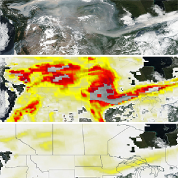
The new PyroCumuloNimbus product for the Ozone Mapping and Profiler Suite (OMPS) makes it easier to track and analyze high concentrations of aerosols from wildfires and similar events.
Feature Article
Nov. 4, 2020

Image captured on 22 December 2019, by the VIIRS instrument, aboard the joint NASA/NOAA Suomi NPP satellite.
Worldview Image of the Week
Nov. 4, 2020

Image captured on 12 May 2019, by the MODIS instrument, aboard the Aqua satellite.
Worldview Image of the Week
Nov. 4, 2020

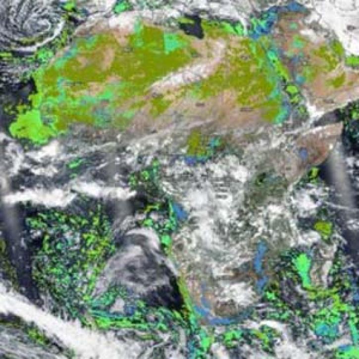
Image captured on 13 September 2020, by the OMPS instrument, aboard the joint NASA/NOAA Suomi NPP satellite.
Worldview Image of the Week
Nov. 4, 2020

Image captured on 21 July 2019, by the VIIRS instrument, aboard the joint NASA/NOAA Suomi NPP satellite.
Worldview Image of the Week
Nov. 3, 2020
Two new near real-time VIIRS products are available for download in NASA’s Land, Atmosphere Near real-time Capability for EOS (LANCE) and for interactive exploration using NASA Worldview.
News
April 30, 2020
SHOWING 8 OF 42