We are in the process of migrating all NASA Earth science data sites into Earthdata from now until end of 2026. Not all NASA Earth science data and resources will appear here until then. Thank you for your patience as we make this transition.
Read about the Web Unification Project
Filters
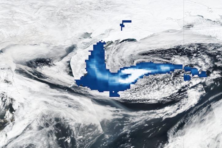
Image captured Apr 12, 2023, by the OMPS and VIIRS instruments aboard the joint NASA/NOAA Suomi NPP satellite.
Worldview Image of the Week
April 13, 2023

Dr. Manil Maskey, deputy manager of NASA’s Interagency Implementation and Advanced Concepts Team (IMPACT) and the IMPACT Airborne Data Management Group (ADMG) are being honored for exceptional accomplishments.
News
April 11, 2023
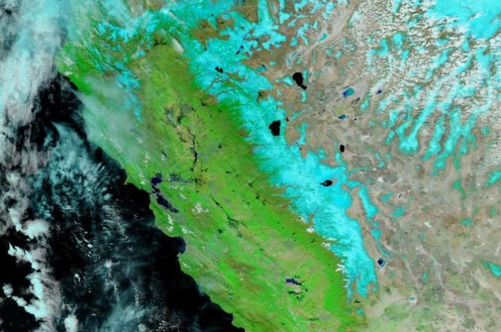
Image captured Apr 5, 2023, by the VIIRS instrument aboard the joint NASA/NOAA NOAA-20 satellite.
Worldview Image of the Week
April 6, 2023

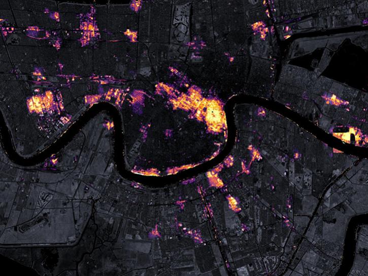
The TEMPO (Tropospheric Emissions: Monitoring Pollution) mission aims to answer this question more precisely than ever by creating a revolutionary new dataset of atmospheric chemistry measurements from space. TEMPO will be the first space-based instrument to monitor major air pollutants across the North American continent every daylight hour at high spatial resolution.
News
April 5, 2023
AppEEARS allows users to subset data spatially, temporally, and by layer, reducing the amount of data they need to download.
Feature Article
April 3, 2023
Five discoveries incorporating NASA Earth science data have been added to the Visualization, Exploration, and Data Analysis (VEDA) Dashboard.
News
March 30, 2023

The report from the 2022 workshop provides recommendations on how NASA can improve the ability for data producers and data users to meet NASA science objectives.
News
March 29, 2023
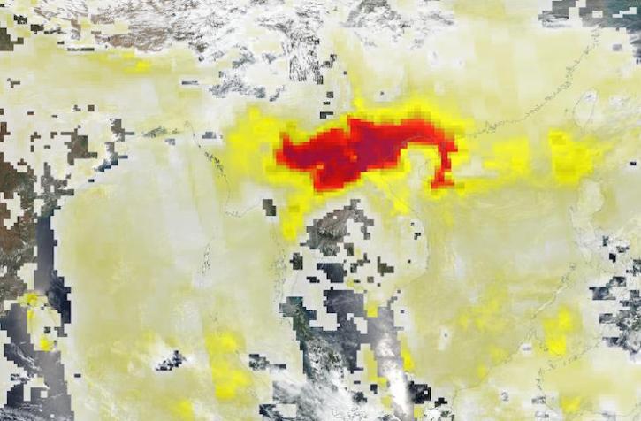
Base image acquired Mar 27, 2023, by the VIIRS instrument aboard the joint NASA/NOAA Suomi NPP satellite, overlaid with Aerosol Index values from the OMPS instrument.
Worldview Image of the Week
March 28, 2023
SHOWING 8 OF 2379