We are in the process of migrating all NASA Earth science data sites into Earthdata from now until end of 2026. Not all NASA Earth science data and resources will appear here until then. Thank you for your patience as we make this transition.
Read about the Web Unification Project
Filters

Download granules from your Vertex queue using a preloaded Python script.
Data Recipe
Sept. 16, 2024

Image captured on Sep 10, 2024, by the VIIRS instrument aboard the joint NASA/NOAA NOAA-20 satellite.
Worldview Image of the Week
Sept. 13, 2024

This year’s hackathon will be held Oct 5 and 6 and feature NASA-created challenges along with 400 local events around the world.
News
Sept. 13, 2024
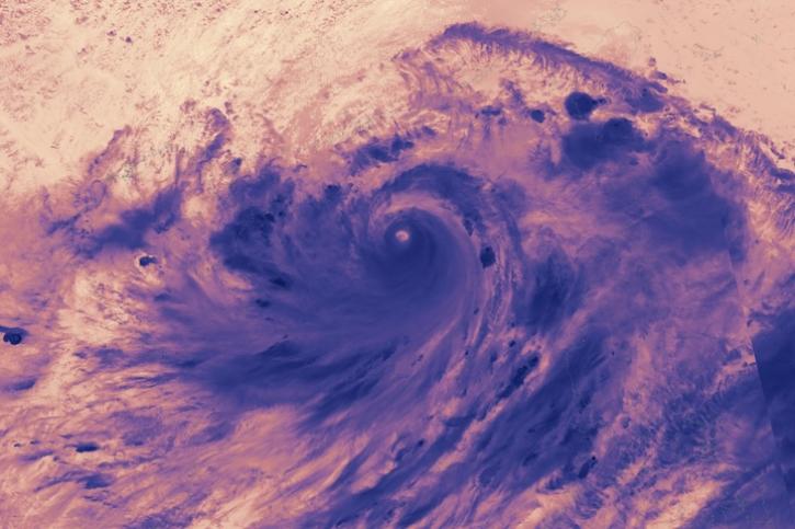
Image captured on Sep 5, 2024, by the VIIRS instrument aboard the joint NASA/NOAA NOAA-21 satellite.
Worldview Image of the Week
Sept. 5, 2024
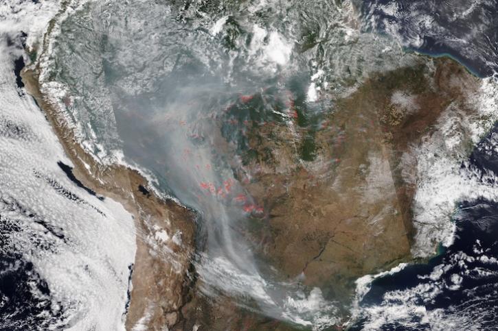
Image captured on Aug 28, 2024, by the VIIRS instrument aboard the joint NASA/NOAA NOAA-20 satellite.
Worldview Image of the Week
Aug. 29, 2024

Hydrocron enables users to receive all Surface Water and Ocean Topography (SWOT) observations for a specific river ID within a specified date range.
News
Aug. 27, 2024

This tutorial demonstrates the impact that water masking can have on your phase unwrapping results.
Tutorial
Aug. 23, 2024

False-color reflectance image of burned areas near the Greek town of Marathon acquired on Aug 18, 2024.
Worldview Image of the Week
Aug. 22, 2024
SHOWING 8 OF 2379